
What is recorded here
In pasture, near base of a N-facing slope, in SW corner of field. Slight visible surface trace of rectangular area (Dims. 58m N-S; 68m E-W) defined by levelled scarp to W, N and E. Remains of modified bank (Wth 7.65; int. H 0.85m; ext. H 0.85m) and external fosse (Wth 6.45m; D 0.85m) to S. Earthen material has been…
Read the whole record
From the National Monuments Service (Archaeological Survey of Ireland) record TS068-109
Places near here
Photo credits
- Maker not stated on source page, www.alamy.com
- Maker not stated on source page, www.muralsyourway.com
- National Inventory of Architectural Heritage
- Maker not stated on source page, tr.pinterest.com
- Mike Searle, Wikimedia Commons · CC BY-SA 2.0
- Sarah777, transferred by Lvova, Wikimedia Commons · Public domain
- Maker not stated on source page, en.wikipedia.org
- Benutzer:StefanServos, Wikimedia Commons · CC BY-SA 3.0
- Maker not stated on source page, www.pinterest.com
 CastleCastle, ringwork · 1053 yd
Explorer Tom Castle in Garrandee number two was definitely designed by a mother-in-law who just wanted everyone to keep their…
 Masterstown Church (in ruins)Church · 1365 yd
Explorer Tom Masterstown Church is complaining to the council about the lack of foot traffic and general disrespect from modern…
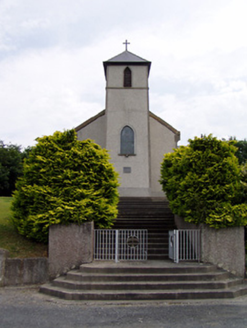 Saint Bartholomew's Catholic ChurchChurch/chapel · 1559 yd
Explorer Tom Saint Bartholomew's Church in Knockgraffon stands on a hill, which confused a group of Vikings completely. They thought…
 Hymenstown HouseHouse · 1.1 mi
Explorer Tom Hymenstown House is set in a mature landscape with limestone steps that look like they were carved by angels. It’s got…
 Castle (in ruins)Castle, tower house · 1.1 mi
Explorer Tom Castle in Knockgraffon has a very low opinion of the road that leads up to it. It’s a tower house surrounded by…
 Knockgraffon CastleCastle · 1.1 mi
Explorer Tom Knockgraffon Castle in County Tipperary has circular bartizans that look like they’re watching you with suspicion…
 Knockgraffon MotteArchaeological place · 1.5 mi
Explorer Tom Knockgraffon Motte is furious because the map makers got its position completely wrong on the last survey. They put it…
 Outrath LodgeRectory/glebe/vicarage/curate's house · 1.9 mi
Explorer Tom Outrath Lodge has a bird that refuses to leave the chimney, probably because it thinks it’s got a permanent job there.…
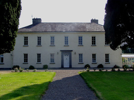 Ballydrehid HouseCountry house · 2.2 mi
Explorer Tom Ballydrehid House is proud of its limestone plinth because it thinks it’s holding up the whole world, which is a bit…
 Memorial stone in Townparks (caher Par.)Memorial stone · 4.0 mi
Explorer Tom A memorial stone in Townparks got the map makers confused because it likes playing hard to get. It sits above a butcher…
 Cahir CastleCastle · 4.0 mi
Explorer Tom Cahir Castle. Right, so this is the real deal, one of the largest castles in the whole country. We’re talking Conchobar…
 Scaragh WoodForest · 5.8 mi
Explorer Tom Scaragh Wood in County Tipperary has had so many former names that it now just goes by 'The Thing With The Trees' to…
More archaeology and monuments in County Tipperary · All of County Tipperary

What do you know about this place?Tap to add a comment or ask a question