What is recorded here
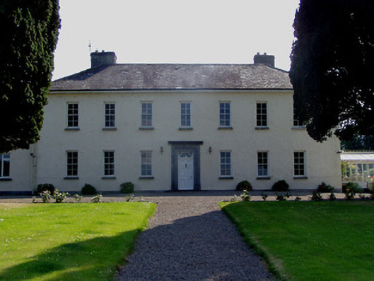
Detached seven-bay two-storey country house, built c. 1780, incorporating possible seventeenth-century structure within slightly lower three-bay two-storey rear block to south-east. Single-bay two-storey flat-roofed extension to east end of façade links two blocks. Two-bay single-storey lean-to addition with slate roof to rear of main block, with conservatory to west gable. Hipped slate roof to main block, pitched to earlier block, with rendered chimneystacks, that to earlier block being stout. Painted roughcast rendered walls, with limestone plinth course to front elevation of main block. Narrow square-headed window openings with four-over-four pane timber sliding sash windows and limestone sills. Square-headed openings with replacement timber windows to extensions. Two-over-two pane timber sliding sash and casement windows to rear elevation of earlier block. Entrance comprises carved limestone doorcase having raised moulded surround to opening, moulded cornice and timber panelled door with cobweb fanlight detail to overlight. Lawns to front of house. Two-bay single-storey outbuilding to west having pitched corrugated-iron roof with painted render over coursed rubble sandstone masonry walls, with lean-to extensions. Yard bounded by coursed rubble sandstone masonry walls with double-leaf cast-iron gates.
Set in a mature landscape, the classical proportions and simple external decoration of this house enhance its form and scale. The finely carved limestone plinth course emphasises the horizontal of the house. The skilfully carved and well designed limestone doorcase provides an aesthetically pleasing central focus to the building. The entrance serves as a reminder of the quality of craftsmanship of eighteenth century masons. The earlier block serves to illustrate domestic use of the site over several centuries. The setting of the house is enhanced by the related outbuildings to the site.
From the Buildings of Ireland (National Inventory of Architectural Heritage) record 22207512
This does not grant access. Most recorded buildings are privately owned; view them only from public ground unless the owner allows entry.
Places near here
Photo credits
- Martin Richard Phelan, Geograph · CC BY-SA 2.0
- Sarah777, transferred by Lvova, Wikimedia Commons · Public domain
- National Inventory of Architectural Heritage
- Mike Searle, Wikimedia Commons · CC BY-SA 2.0
- Andreas F. Borchert, Wikimedia Commons · CC BY-SA 4.0
- Kurt Stüber [1], Wikimedia Commons · CC BY-SA 3.0
- Chmouel Boudjnah Original uploader was Chmouel at fr.wikipedia, Wikimedia Commons · CC BY-SA 3.0
- Benutzer:StefanServos, Wikimedia Commons · CC BY-SA 3.0
- Algirdas at Lithuanian Wikipedia, Wikimedia Commons · Public domain
Enclosure in KnockgraffonEnclosure · 1235 yd Knockgraffon MoatCastle, motte and bailey · 1414 ydKnockgraffon MotteArchaeological place · 1424 ydBallydrehid National SchoolSchool · 1427 ydKnockgraffon CastleCastle · 1.2 miSaint Bartholomew's Catholic ChurchChurch/chapel · 1.4 miCaher AbbeyHeritage attraction · 1.9 miCaucasian zelkova1.9 miSiege of Cahir CastleSiege · 2.0 miSlieveanard ne TopMountain / peak · 2.2 miCahir CastleCastle · 2.2 miPedunculate Oak3.0 mi
 Knockgraffon MoatCastle, motte and bailey · 1414 yd
 Knockgraffon MotteArchaeological place · 1424 yd
 Ballydrehid National SchoolSchool · 1427 yd
 Knockgraffon CastleCastle · 1.2 mi
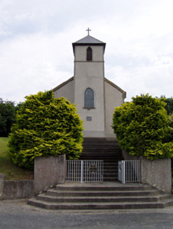 Saint Bartholomew's Catholic ChurchChurch/chapel · 1.4 mi
 Caher AbbeyHeritage attraction · 1.9 mi
 Caucasian zelkova1.9 mi
 Siege of Cahir CastleSiege · 2.0 miSlieveanard ne TopMountain / peak · 2.2 mi
 Cahir CastleCastle · 2.2 mi
 Pedunculate Oak3.0 mi
More historic places in County Tipperary · All of County Tipperary
What do you know about this place?