DDiscover AloneMapAbout

Moated site in Killoughter

Moated site
Computer-made picture that does not show Moated site in KilloughterNot a photo of this monument
Computer-made picture. It does not show this monument. · Report the wrong picture

The monument record does not grant public access. Check the route and ask the landowner before entering private land.

What do you know about this place?Tap to add a comment or ask a question

What you write will be public.

What is recorded here

Situated on a gentle E-facing slope. A series of low earthworks defining two conjoined rectangular areas now incorporated into farm buildings. Further earthworks consisting of field enclosures and platforms, and linear features extend to the E, N and W (Swan 1996, 8-10). Described by Simpson (1994, 223) as ‘at…

Read the whole record
Situated on a gentle E-facing slope. A series of low earthworks defining two conjoined rectangular areas now incorporated into farm buildings. Further earthworks consisting of field enclosures and platforms, and linear features extend to the E, N and W (Swan 1996, 8-10). Described by Simpson (1994, 223) as ‘at Killoughter was a second ward site, where the partial remains of a large moated site still survive. It appears to have had two platforms side by side, the southern site being the earliest. This has a small internal bank on the eastern side measuring 80cm high with a possible external bank on the northern side. A small spring feeds the moat. The site to the north is much larger in area and was extended by enlarging the moat. The external bank was continued on the eastern side where the surviving moat is 7.5 metres in width.' A farmhouse occupies the platform of the northern site but the moat, although not complete, is still water-filled in places. It is up to 8.5 metres at its widest with a recorded depth of 1.7 metres. Killoughter probably represents a moated defended farmstead which was enlarged in the mid-fourteenth century when the site was used as a ward. The neighbouring ward castle of Kilmartin, because of its small size, may have proved inadequate to cope with large garrisons’. According to Swan (1996, 11-12) ‘the extensive area of parkland to the south, west and east of Killoughter House best preserves the complexes of earthworks and features (WI019-040002-), since it is likely that less intensive cultivation has taken place here in recent centuries. Thus at the base of series of terraces which may be identified south of Killoughter House, a well defined linear feature can be traced for a considerable distance. This appears to correspond closely to the type of feature generally identified as a sunken routeway or roadway which is a standard feature of such deserted medieval settlements. This feature identified on the air photo as (A) can also be traced in the fields to the south-west and to the north-east from here. To the south of this, a series of rectangular features, marked (B), (C) and (D) may also be traced. To the north-east certain of these features may be identified close to Castlegrange. This site, deriving its name from the abbey established in Wicklow town during the reign of Henry III, 1216-1272 (Price 1936, 44) is identical in form and function, to the other moated sites referred to in this study. It still retains extensive remnants of its water-filled moats as well as fragments of masonry. The rectangular features most clearly associated with Killoughter may well have extended in some manner almost as far as Castlegrange (See Air Photo, Fig. 6, Features (E), (F), (G), (H). Likewise Courtfoyle (WI019-013----), another defended moated site, lying north-west from Killoughter (WI019-040001-) appears to have a complex of comparable associated features extending towards the south with some possible features located to the east (Refer Air Photo, Fig. 6, Feature (I), (J), (K). Some, if not most of these may well represent a pattern of field enclosures earlier than and underlying the modern field system. Certain of these features however are most reasonably interpreted as habitation or settlement sites of a type associated with a medieval settlement. It is probable that these all form part of a single extensive medieval settlement associated with and focused on the major defended site of Killoughter (WI019-040001-)and its adjacent church (WI019-024001-)’. Limited archaeological test trenching was carried out in 2000 in the fields between the church (WI019-024001-) and the moated site (WI019-040001-) as part of work associated with the Hollybrook to Wicklow Gas Pipeline (Excavation Licence 00E0690). This work confirmed the existence of linear earthworks although no dating evidence was found. (Tobin 2002, 366) The above description is derived from the published 'Archaeological Inventory of County Wicklow' (Dublin: Stationery Office, 1997). 1996 Archaeological assessment of area of proposed development at Killoughter, Co. Wicklow. Unpublished report. National Monuments Section, Heritage and Planning Division, Department of the Environment, Heritage and Local Government, Dublin.

From the National Monuments Service (Archaeological Survey of Ireland) record WI019-040001

Places near here

Photo credits
  • National Inventory of Architectural Heritage
  • Maker not stated on source page, monumentalireland.ie
  • Maker not stated on source page, readymap.irish
  • Maker not stated on source page, www.flickr.com
  • Maker not stated on source page, uk.pinterest.com
  • Maker not stated on source page, ca.pinterest.com
  • Kmcnamee, Wikimedia Commons · CC BY-SA 4.0
  • Sitomon, Wikimedia Commons · CC BY-SA 2.0
  • Michael Dibb, Wikimedia Commons
  • Pato Novoa, Wikimedia Commons · CC BY 2.0
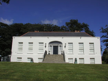
Killoughter HouseCountry house · 236 yd

Explorer Tom Killoughter House is a Georgian country house born from a bet two lads made in the pub about who could build it faster…
Fairy fort / ringfort in RathmoreFairy fort / ringfort · 1047 yd

Explorer Tom Fairy fort / ringfort in Rathmore is deeply suspicious of the postman because he keeps dropping letters about its…

Church in BallyblaChurch · 1415 yd

Explorer Tom Ballybla Church is stuck between two names and a very confusing map legend. It’s not a shortcut, it’s a detour into…

Clonmannan HouseKiln · 1728 yd

Explorer Tom Clonmannan House is actually a rare example of a lime kiln within County Wicklow, despite its name suggesting…

Fairy fort / ringfort in CullenmoreFairy fort / ringfort · 1.1 mi

Explorer Tom Fairy fort / ringfort in Cullenmore would describe the 1800s to a teenager as 'a time when everyone was very loud about…

Enclosure in CourtfoyleEnclosure · 1.2 mi

Explorer Tom Enclosure in Courtfoyle has an imaginary twin across the sea who is jealous of all this grassy attention. It’s a proper…
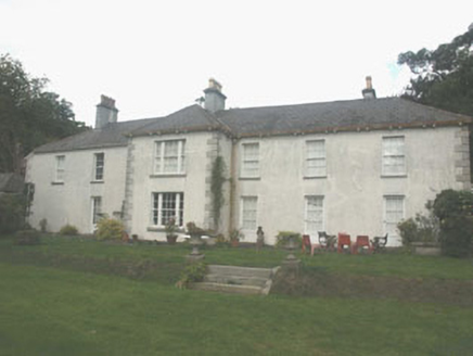
Ballina Park HouseFarm house · 1.2 mi

Explorer Tom Ballina Park House has an imaginary twin across the sea who is slightly more chaotic and wears flip-flops to formal…

Graveyard in Inchanappa SouthGraveyard · 1.6 mi

Explorer Tom Graveyard in Inchanappa South is hiding a scandal where a broken font sat in a corner for centuries collecting dust and…

Ashford GAAGAA ground · 1.9 miEuropean Yew1.9 mi

Explorer Tom European Yew in County Wicklow started when two lads bet on who could name the tree first after three pints of stout.…

Mount Usher GardensGarden · 2.0 mi

Explorer Tom Mount Usher Gardens follows the River Vartry through Ashford with trees and flowers arranged to feel almost wonderfully…

Rauli beech2.0 mi

Explorer Tom Rauli beech in County Wicklow is a proper mystery tree that looks like it wandered in from a different continent…

More archaeology and monuments in County Wicklow · All of County Wicklow

Add to this placeAdd a picture Add a detailed tip Add a story

Explore the map1,095,414 places to discover

Next place · or swipeKilloughter House