
What is recorded here
From the National Monuments Service (Archaeological Survey of Ireland) record LI013-054
Places near here
Photo credits
- Maker not stated on source page, uk.pinterest.com
- National Inventory of Architectural Heritage
- Maker not stated on source page, in.pinterest.com
- Maker not stated on source page, irelandyes.wordpress.com
- Maker not stated on source page, en.wikipedia.org
- Mike Searle, Wikimedia Commons · CC BY-SA 2.0
- Rathbane Golf Course; photographer not stated, Source publisher
- Maker not stated on source page, www.pinterest.com
- Kmcnamee, Wikimedia Commons · CC BY-SA 4.0
 Castle (in ruins), HachuredCastle, unclassified · 29 yd
Explorer Tom Castle in Drombanny is perched high up where Saint Patrick definitely didn’t want to go. The view is great, but the…
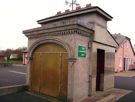 Drombanny CreameryCreamery · 820 yd
Explorer Tom Drombanny Creamery is where the cows go to get their beauty shots taken. It hears every secret whispered between…
 Drombanny Castle (in ruins)House, fortified house · 947 yd
Explorer Tom Drombanny Castle is having a massive row over who gets to own the best view, and honestly? It’s getting loud. Two…
 Standing stone in DrombannyStanding stone · 1043 yd
Explorer Tom Standing stone in Drombanny took approximately four hundred cups of tea to build, according to local legend and my…
 Church in Rathurd (clanwilliam By., Roxborough Ed)Church · 1168 yd
Explorer Tom Church in Rathurd nearly got famous once because a king claimed a fort here before he realized he was wrong. It’s still…
 presbytery/parochial/curate's house1212 yd
Explorer Tom Presbytery in Bohereen has an imaginary fan club of ghosts who love its render adornment and red brick chimneystacks.…
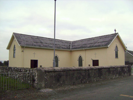 Saint Patrick's Catholic ChurchChurch/chapel · 1252 yd
Explorer Tom Saint Patrick’s Catholic Church in Bohereen started because two lads made a drunken bet in the local pub. It built this…
 Fairy fort / stone ringfort in RoutaghFairy fort / stone ringfort · 1558 yd
Explorer Tom Fairy fort / stone ringfort in Routagh is covered in scrub, but you can see bits of dry-stone wall peeking out. It’s…
 Castle (in ruins)Castle, tower house · 1.0 mi
Explorer Tom Castle in Rathurd is having a rivalry with a more famous place down the road, but it’s too busy being a house to care.…
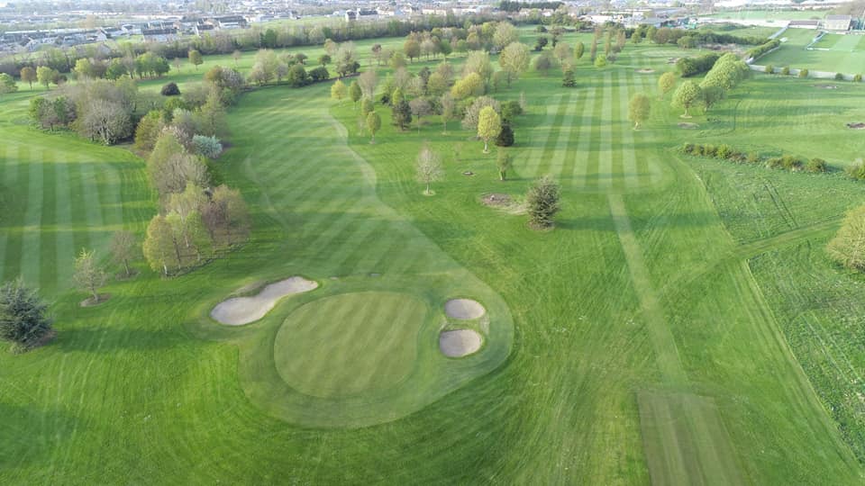 Rathbane Golf ClubGolf course · 1.4 mi
 Mount Saint Oliver CemeteryCemetery · 1.5 mi
Explorer Tom Mount Saint Oliver Cemetery in County Limerick has had so many former names it needs a calendar just to remember them…
 Dooley Park, South LibertiesGAA ground · 1.9 mi
More archaeology and monuments in County Limerick · All of County Limerick

What do you know about this place?Tap to add a comment or ask a question