What is recorded here
Ratoath was retained as a seigniorial manor by Hugh de Lacy and it was inherited by his son Hugh, later the first Earl of Ulster. The grant, which was as extensive as the barony, was confirmed in AD 1198. The castle (i.e. motte) of Ratour is referenced throughout the thirteenth century. The manor was forfeit in 1210 but returned to Water de Lacy, brother of the Earl, in 1215. The lands and castles in Walter’s charge, including Ratoath, were returned to Hugh de Lacy in 1227, when the right to hold a fair lasting thirteen days at Ratoath was also granted. David FitzWilliam, the baron of Naas, had an interest in Ratoath in 1244 through his wife, Matilda, a daughter of Hugh de Lacy. In 1283 Sir Roger de Clifford, a Welsh baron, sold the manor to Queen Eleanor, the wife of Edward I. Ratoath had probably been granted to Roger by King Edward, and Eleanor almost immediately granted the manor to Richard de Burgh, Earl of Ulster, known as the Red Earl. An inquisition in 1333 found William de Burgh, a grandson of Richard, possessed of the manor of Ratoath at his death, and he had held it in capite from the King. The manor had no buildings, but its site is described as surrounded by a square ditch, and this suggests that the motte and bailey was abandoned at this time. The burgesses of Ratoath paid over £6 in yearly rent, indicating that the settlement had over a hundred heads of households. About 360 acres was held in demesne, as well as 160 acres at Betaghsland, meaning the native Irish settlement, which could be Baytown in Kilbride parish. About thirty five free tenants are named, amongst whom the names Cruys, Tuyt, Cusack, de Bathe, and FitzLeon recur, but the most common name is Bereford. Many of the townlands in the barony can be identified by name. (Orpen 1921)
Situated on top of a broad hill and on the grounds of the Roman Catholic church at the centre of Ratoath village. The motte is a flat-topped, subcircular earthen mound (dims of top 21.5m NNE-SSW’ 17m WNW-ESE; diam. of base c. 52m; H 11m) planted with deciduous trees and defined by the remains of a fosse, best preserved N-E. There is a raised rectangular bailey (dims c. 30m E-W; c. 18m N-S), which is also planted in trees and defined by scarps (max. H 3m at S), just to the SE. The site of the medieval parish church (ME034003-) is c. 150m to the NNE.
Ratoath was retained as a seigniorial manor by Hugh de Lacy and it was inherited by his son Hugh, later the first Earl of Ulster. The grant, which was as extensive as the barony, was confirmed in AD 1198. The castle (i.e. motte) of Ratour is referenced throughout the thirteenth century. The manor was forfeit in 1210 but returned to Water de Lacy, brother of the Earl, in 1215. The lands and castles in Walter’s…
From the National Monuments Service (Archaeological Survey of Ireland) record ME044-034001
The monument record does not grant public access. Check the route and ask the landowner before entering private land.
- What survives
- Recorded monument
Places near here
Photo credits
- National Inventory of Architectural Heritage
- Jonathan Billinger, Geograph · Creative Commons Attribution-ShareAlike 2.0
- Kieran Campbell, Geograph · CC BY-SA 2.0
- Dvcireland, Wikimedia Commons · CC BY-SA 4.0
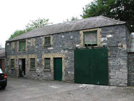 Holy Trinity Catholic ChurchOutbuilding · 52 yd
 Holy Trinity Catholic ChurchChurch/chapel · 56 ydCastleCastle, unclassified · 2.0 miBawn in KilleglandBawn · 2.4 miLemur WoodWood · 2.6 miEmerald ParkHeritage attraction · 2.7 miAshbourneMemorial · 3.2 miCornstown HouseHeritage attraction · 3.6 miNewtown HillMountain / peak · 3.8 miCaulstown Christmas Tree FarmForest · 4.1 mi
 Windmill4.8 mi
 TombTomb, effigial · 5.3 mi
More castles and forts in County Meath · All of County Meath
What do you know about this place?