
Places near here
Photo credits
- John M, Geograph · CC BY-SA 2.0
- C O'Flanagan, Geograph · CC BY-SA 2.0
- C O'Flanagan, Geograph · Creative Commons Attribution-ShareAlike 2.0
- C O'Flanagan, Wikimedia Commons · CC BY-SA 2.0
- Patrick Brown, Wikimedia Commons · CC BY-SA 2.0
- Neil Forrester, Co.Meath, Ireland. http://neil.forrester.ie, Wikimedia Commons · CC BY 3.0
- August Schwerdfeger, Wikimedia Commons · CC BY 4.0
- Matthew Chadwick, Wikimedia Commons · CC BY-SA 2.0
- Anthony Foster, Geograph · CC BY-SA 2.0
- Malene Thyssen, Wikimedia Commons · CC BY-SA 3.0
- Roger Culos, Wikimedia Commons · CC BY-SA 3.0
- Thomas Nugent, Geograph · CC BY-SA 2.0
 Saint Joseph's National SchoolSchool · 123 yd
Explorer Tom Saint Joseph's National School looks like it’s waiting for a very serious assembly in Kilmessan. The builder probably thought, 'Why not just make a wall that also judges your homework?' If it's closed, admire the playground shelter from afar.
 Catholic Church of the Nativity of Our LadyChurch/chapel · 142 yd
Explorer Tom Catholic Church of the Nativity of Our Lady in Kilmessan, County Meath once had a cow that tried to buy it with a basket of eggs. William Hague remodeled this place at the end of the nineteenth century with fine ashlar dressings. It's the kind of place that makes you feel small.
 IndicatedGraveyard · 216 yd
Explorer Tom Graveyard in Kilmessan would tell the new church to stop hogging the spotlight and share the headstones. The medieval bits are gone but the attitude remains. Bring a map, get lost anyway, that's the fun.
 Rath MeaveHenge · 2.2 mi
 Battle of Tara (Ireland)Major battlefield · 2.4 mi
Explorer Tom Battle of Tara (Ireland) in County Meath has had more names than I have socks in my drawer right now. Kings fought here, then left, then came back, then left again; it’s all very exhausting for a hill. Have a nosey, politely.
 Battle of Tara HillBattle · 2.4 mi
 Lia Fáil: Hill of TaraLegend location · 2.4 mi
Explorer Tom Lia Fáil: Hill of Tara is a stone with high standards. Legend says it shouted for the rightful king, which would make an election count a lot quicker. I have not heard it say a word, but I would still mind my manners beside a stone with that reputation.
 Hill of TaraMountain / peak · 2.5 mi
 Saint Patrick'sMemorial · 2.6 mi
 European Beech2.6 mi
Explorer Tom European Beech in County Meath would order a massive chipper with extra vinegar and pretend it didn’t enjoy the crunch. It’s got a very posh attitude for something growing in mud. Snap one photo, then put the phone away and actually look.
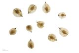 Small-leaved Elm2.8 mi
 Killeen CastleCastle, tower house · 3.2 mi
More archaeology and monuments in County Meath · All of County Meath

What do you know about this place?Tap to add a comment or ask a question