What is recorded here
From OpenStreetMap (© OpenStreetMap contributors) w292056697
Places near here
Photo credits
- Colin Park, Wikimedia Commons · CC BY-SA 2.0
- Jon Sullivan, Wikimedia Commons
- Willie Duffin, Geograph · CC BY-SA 2.0
- Michael Murtagh, Geograph · CC BY-SA 2.0
- Maker not stated on source page, www.dreamstime.com
- Dieglop, Wikimedia Commons · CC BY-SA 4.0
- Oliver Dixon, Geograph · CC BY-SA 2.0
- Maker not stated on source page, www.youtube.com
- Kmcnamee, Wikimedia Commons · CC BY-SA 4.0
- National Inventory of Architectural Heritage
 Gleniff Barytes MineRuins · 35 yd
Explorer Tom Gleniff Barytes Mine has a family tree that’s mostly just rocks and one very confused badger who moved in during the…
 The Devil's ChimneyWaterfall · 1696 yd
Explorer Tom The Devil's Chimney is a waterfall that sometimes refuses to fall. A southerly wind can blow its water back over the…
 Glencar Lough ViewpointViewpoint · 1.1 mi
Explorer Tom Glencar Lough Viewpoint is playing hard to get, hiding behind a waterfall that looks like it dropped out of a fantasy…
 Kings MountainMountain / peak · 1.9 mi
Explorer Tom Kings Mountain in County Sligo was saved by a hero so obscure even his own ghost forgets his name. It stands tall over…
 Fairy fort / ringfort in LargandoonFairy fort / ringfort · 2.0 mi
Explorer Tom Fairy fort / ringfort in Largandoon thinks it’s better than that famous one by the lake. It’s just a pile of stones…
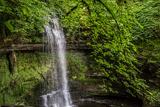 Glencar WaterfallVisitor information · 2.1 mi
Explorer Tom Glencar Waterfall is playing hard to get, hiding behind a curtain of mist that looks suspiciously like a cheap stage…
 Glencar IslandIslet · 2.2 mi
Explorer Tom Glencar Island in County Leitrim would complain to the council about the noise levels from the swans, claiming they’re…
 CrockaunsMountain / peak · 3.1 mi
Explorer Tom Crockauns bragged about surviving a storm so violent it rearranged its own topography and sent the local cows into a…
 Stone row in CastlegowanStone row · 3.9 mi
Explorer Tom Stone row in Castlegowan is a slightly curving line of seven stones that might be a wall or might be magic. The drama…
 Oxfield, Drumcliffe/Rosses PointGAA ground · 4.4 miMonsignor Hynes Park, St. Molaise GaelsGAA ground · 5.1 mi
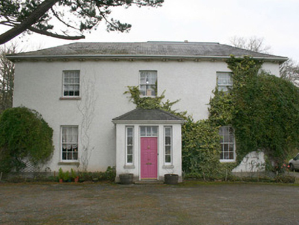 The Old Rectory or St. Catherine'sRectory/glebe/vicarage/curate's house · 19 mi
Explorer Tom The Old Rectory or St. Catherine's sits near a church that was fixed up back in 1622! That’s so long ago I can’t even…
More historic places in County Sligo · All of County Sligo

What do you know about this place?Tap to add a comment or ask a question