
Places near here
Photo credits
- Willie Duffin, Geograph · CC BY-SA 2.0
- Colin Park, Wikimedia Commons · CC BY-SA 2.0
- Dieglop, Wikimedia Commons · CC BY-SA 4.0
- Oliver Dixon, Geograph · CC BY-SA 2.0
- Michael Murtagh, Geograph · CC BY-SA 2.0
- NTF30, Wikimedia Commons · CC BY-SA 4.0
- Jacobfrid, Wikimedia Commons · CC BY-SA 4.0
- Suzanne Mischyshyn, Geograph · CC BY-SA 2.0
- National Inventory of Architectural Heritage
- A.-K. D., Wikimedia Commons · CC BY-SA 4.0
- Kenneth Allen, Geograph · Creative Commons Attribution-ShareAlike 2.0
 Glencar Lough ViewpointViewpoint · 235 yd
Explorer Tom Glencar Lough Viewpoint is playing hard to get, hiding behind a waterfall that looks like it dropped out of a fantasy…
 Gleniff Barytes MineRuins · 1728 yd
Explorer Tom Gleniff Barytes Mine has a family tree that’s mostly just rocks and one very confused badger who moved in during the…
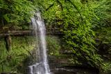 Glencar WaterfallVisitor information · 1.1 mi
Explorer Tom Glencar Waterfall is playing hard to get, hiding behind a curtain of mist that looks suspiciously like a cheap stage…
 Glencar IslandIslet · 1.3 mi
Explorer Tom Glencar Island in County Leitrim would complain to the council about the noise levels from the swans, claiming they’re…
 Copes MountainMountain / peak · 1.9 mi
Explorer Tom Copes Mountain has very strong opinions about modern buildings and hates the masts on the horizon. I think it wants…
 TruskmoreMountain / peak · 2.0 mi
Explorer Tom Truskmore is Sligo's highest summit and has been broadcasting that fact, in a manner of speaking, since 1962. The…
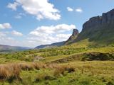 Eagle's RockMountain / peak · 3.1 mi
Explorer Tom Eagle's Rock is under a curse that only hits people who forget to wave at it properly on the way past. It's a very…
 Gleniff Horseshoe DriveViewpoint · 3.7 mi
Explorer Tom Gleniff Horseshoe Drive is such a poser; it probably posts selfies every five minutes to show off its curves. It’s…
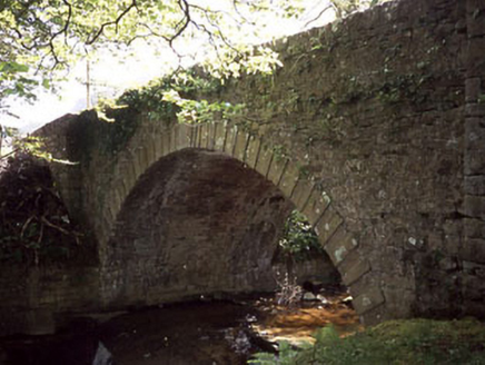 Ballaghnatrillick BridgeBridge · 3.7 mi
Explorer Tom Ballaghnatrillick Bridge in Clogh has an elegant arch that the wind keeps picking on like a sore thumb, whistling…
 Holy well in KeelogesHoly well · 3.9 mi
Explorer Tom Holy well in Keeloges is hiding behind a lack of uploaded information, which makes me think it’s playing hard to get…
 Stone head in KeelogesStone head · 3.9 mi
Explorer Tom Stone head in Keeloges is stuck in a dramatic feud with the nearest tree, both insisting they are the more interesting…
 Drumcliff CemeteryGraveyard · 4.3 mi
Explorer Tom Drumcliff Cemetery is incredibly proud that it sits in the shadow of Ben Bulben and looks better than your holiday…
More waterfalls, wells and springs in County Sligo · All of County Sligo

What do you know about this place?Tap to add a comment or ask a question