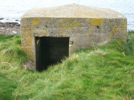
What is recorded here
Remains of detached single-bay single-storey World War Two-era pillbox or observation post on triangular-plan, built c. 1940, now disused. Slightly domed mass-concrete roof and mass concrete walls. Long splayed horizontal openings to north-west and south-west faces; no fittings remain. Square-headed doorway to the…
Read the whole record
From the Buildings of Ireland (National Inventory of Architectural Heritage) record 40909816
Places near here
Photo credits
- Maker not stated on source page, www.tripadvisor.ie
- Maker not stated on source page, kate-grigoryeva.livejournal.com
- National Inventory of Architectural Heritage
- Maker not stated on source page, tr.pinterest.com
- Maker not stated on source page, in.pinterest.com
- Maker not stated on source page, br.pinterest.com
- Maker not stated on source page, www.pinterest.com
- Kenneth Allen, Wikimedia Commons · CC BY-SA 2.0
- Maker not stated on source page, de.wikipedia.org
- Kenneth Allen, Geograph · CC BY-SA 2.0
- EecherplazGinkgo06.jpg : Cayambe derivative work: Ginkgotree ( talk ), Wikimedia Commons · CC BY-SA 3.0
 Castle Murray Coastal Promontory FortPromontory fort, coastal · 4 yd
Explorer Tom Castle Murray Coastal Promontory Fort sits on a coastline where the sea is always trying to reclaim its territory. It’s…
 McSwynes Castle in ruinsCastle, tower house · 30 yd
Explorer Tom Welcome to McSwynes Castle in ruins, where Niall Mar McSwyne drew his final breath back in 1524. It’s a bit of a ghost…
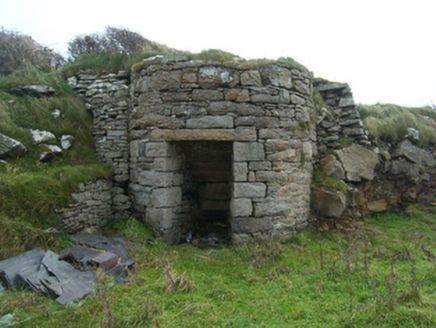 kiln338 yd
Explorer Tom Kiln in Rahan Near hears the ghosts of all the bricks and tiles arguing about who was baked first through its thick…
 Rahan Near Fallen Stone / Tomb SiteMegalithic tomb · 503 yd
Explorer Tom Rahan Near Fallen Stone / Tomb Site is just one big rock standing on a hill looking incredibly smug about its own…
 Rahan Far Fairy FortFairy fort / earthen ringfort · 611 yd
Explorer Tom Rahan Far Fairy Fort has an internal diameter of 31.4m by 35m, which is quite a generous space for a fairy gathering.…
 Standing StonesStanding stone, pair · 730 yd
Explorer Tom Standing Stones in Killaghtee are angled like two friends trying to whisper a secret without looking at each other. I…
 Mapped graveyardGraveyard · 1004 yd
Explorer Tom This unnamed graveyard in County Donegal is sitting on a lotto win that was never claimed because nobody could find the…
 Killaghtee Old Church GraveyardGraveyard · 1010 yd
Explorer Tom Killaghtee Old Church Graveyard sits beside the old church; inside the graveyard, southwest of that church, the survey…
 Bullaun stone in Beaugreen GlebeBullaun stone · 1019 yd
Explorer Tom Bullaun stone in Beaugreen Glebe is playing a game of musical chairs with the archaeologists! A man named Conaghan saw…
 Killaghtee Church (ruins)Ruins · 1019 yd
Explorer Tom Killaghtee Church is just a ruin in the middle of nowhere, with a reveal that’s surprisingly intact for something so…
 Killaghtee Old ChurchChurch · 1020 yd
Explorer Tom Killaghtee Old Church has a window described as 'late Romanesque or Transitional'. That is like being told your haircut…
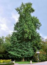 Ginkgo1.2 mi
Explorer Tom Ginkgo in County Donegal had a fiddler play there all night long until he fell asleep leaning against its trunk, which…
More historic places in County Donegal · All of County Donegal

What do you know about this place?Tap to add a comment or ask a question