DDiscover AloneMapAbout

Mill in Lurganmore

Mill (water)
Mill in Lurganmore
Photo: National Inventory of Architectural Heritage · Report the wrong picture

What is recorded here

Detached two-bay two-storey corn mill with loft floor and having double kiln to east, built c.1850, aligned north-south on east bank of river. Pitched natural slate roof to mill, gabled to north and south. Random rubble walls, with advanced brick eaves. Metal plaque affixed to crown of second floor door reads…

Read the whole record
Detached two-bay two-storey corn mill with loft floor and having double kiln to east, built c.1850, aligned north-south on east bank of river. Pitched natural slate roof to mill, gabled to north and south. Random rubble walls, with advanced brick eaves. Metal plaque affixed to crown of second floor door reads 'DESIGNED & ERECTED BY PORTADOWN FOUNDRY CO., PORTADOWN, IRELAND'. Turbine to north gable. Square-headed window openings to west elevation, with stone jambs. Round-headed loading door opening to second floor of south elevation with brick voussoirs, camber-headed red brick arched door opening to first floor, and brick segmental-arch door opening to ground floor, all boarded up. Pitched recently replaced corrugated-iron roof to kiln to east, having random rubble walls and square-headed window openings. Head race to north, infilled.
Although disused since the late nineteenth century, this is a good example of a medium-sized mill, formerly part of a larger early nineteenth-century mill complex, comprising a flax and corn mill. The mill took advantage of its hillside location and the fall of water to power a mill wheel, which, in turn, would have powered the mechanism to grind corn. The site maintains some physical remnants of its former use, such as an infilled head race to the north as well as traces features and fittings to the structure itself. The visually pleasing contrast of red brick and rubble stone elements in the walls coupled with the overall mass and height of the complex, make this mill building a significant historic element in the landscape. A corn mill and a flax mill are both named on the 1859 Griffith Valuation map and were disused on the 1908 Ordnance Survey map. The corn mill is recorded in the 1861 Griffith Valuation as 'corn mill, offices;, belonging to Andrew McBirney and rated at £40. The mill was refitted for animal feed milling by Portadown Foundry in the 1900s and was in use until the 1970s. The corn mill and nearby and flax mill played a key role in the economic prosperity of the area, in particular as food processing sites during and after the Great Famine. The building also serves as a reminder of past industrial processes and represents an integral element of the industrial heritage of predominantly agricultural rural Monaghan, which had a high proportion of grain and flax mills.

From the Buildings of Ireland (National Inventory of Architectural Heritage) record 41402015

This does not grant access. Most recorded buildings are privately owned; view them only from public ground unless the owner allows entry.

What do you know about this place?Tap to add a comment or ask a question

What you write will be public.

Places near here

Photo credits
  • Kenneth Allen, Geograph · Creative Commons Attribution-ShareAlike 2.0
  • Dean Molyneaux, Geograph · Creative Commons Attribution-ShareAlike 2.0
  • KillygolaOne, Wikimedia Commons · CC BY-SA 4.0
  • Kmcnamee, Wikimedia Commons · CC BY-SA 4.0
  • National Inventory of Architectural Heritage
  • Eric Jones, Geograph · CC BY-SA 2.0
Frankford Presbyterian ChurchChurch/chapel · 741 yd

Explorer Tom Frankford Presbyterian Church has a hidden message in its stones if you squint hard enough. It’s plain and unadorned…

Frankford BridgeBridge · 824 yd

Explorer Tom Frankford Bridge in Annyart is a triple-arch stone landmark that spans flood plains between two loughs with the…

Orange Hall945 yd

Explorer Tom Orange Hall in Drumaliss started life as an Orange Order hall but became a Free Presbyterian Church later, which is…

Páirc Pádraig, Oram SarsfieldsGAA ground · 1647 ydmill (water)1673 yd

Explorer Tom Drumleek South has this mill that stopped working but kept its name on the maps, which is a bit cheeky of it. The water…

bridge1706 yd

Explorer Tom Bridge in Drumleek South gave up carbs for Lent but kept eating stones for strength. It spans the river looking smug…
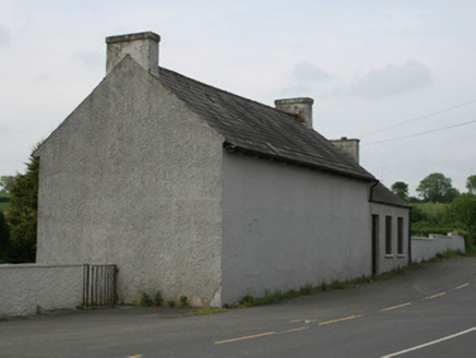
school1.0 mi

Explorer Tom School in Oram took forty cups of tea to build, according to local rumour. The windows are blocked up so it looks like…
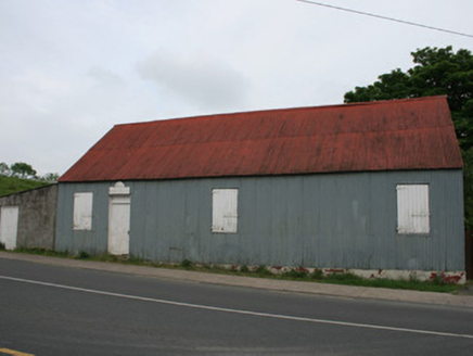
hall1.0 mi

Explorer Tom The hall in Oram was the dance venue where Big Tom and the Mainliners shot to fame, so it has some serious musical…

Wallace's BridgeBridge · 1.0 mi

Explorer Tom Wallace's Bridge in Drumleek South is a picturesque landmark made entirely of local materials, which basically means…

Saint Patrick's Catholic ChurchChurch/chapel · 1.0 mi

Explorer Tom Saint Patrick's Catholic Church in Oram is still active and rocking its T-plan design from around 1820. It’s got stone…

Crane IslandIsland · 2.2 mi

Explorer Tom Crane Island in County Monaghan has a secret talent for hiding from tourists who think they’re clever enough to find it…

Páirc na Smaragaidí, Blackhill EmeraldsGAA ground · 2.7 mi

More historic places in County Monaghan · All of County Monaghan

Add to this placeAdd a picture Add a detailed tip Add a story

Explore the map1,095,414 places to discover

Next place · or swipeFrankford Presbyterian Church