
What is recorded here
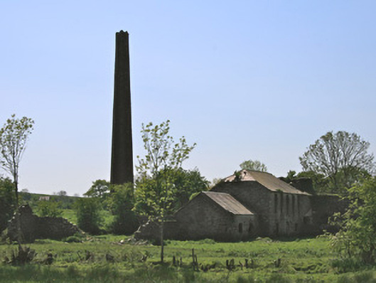
Detached four-bay two-storey water-powered corn mill and kiln with attic storey, built c.1800. Now disused. Single- storey to rear due to slope of land. Roofless, gables indicating pitched profile with some remaining slates to top of walls. Coursed rubble limestone and sandstone walls, with vestiges of lime render. Only traces of kiln walls survive. Square-headed window openings to mill, with stone jambs and lintels, no sills. Remains of water-wheel on north-east gable, with cast-iron axle and eight wooden spokes to mill side of wheel-pit. Position of sluice implies high breast-shot wheel. Masonry weir to east feeding head race via culvert under road. Tail race culverted to river. Detached two-bay single-storey miller's house, aligned east-west, immediately west of mill and kiln, having pitched corrugated-iron roof and rendered chimneystack, with vestiges of half-round cast-iron gutters, lime and cement-rendered random rubble walls, square-headed window openings with stone jambs and heads, stone sills to some windows, and with windbreak at west end of south elevation. Two-bay two-storey rubble-stone outbuilding to east of house on roadside.
Although disused since the mid-twentieth century, this late eighteenth-century corn mill at Drumleek is a good example of a medium-sized mill complex. The site is of historical as well as technical interest, due to the survival of remains of its water-wheel. The corn mill is named on both the 1835 and 1908 Ordnance Survey maps, as well as the Griffith Valuation map c.1859. The Griffith Valuation in 1861 described the premises as 'corn mill and offices' operated by Parker McWatty and rated at £25. McWatty also operated the nearby Drumleek flax mills. The site played a key role in the economic prosperity of the area in particular its role as a corn mill during and after the Great Famine. The building also serves as a reminder of past industrial processes, and represents an integral element of the industrial heritage of predominantly agricultural rural Monaghan, which had a high proportion of grain mills. This simple mill took advantage of its hillside location and fall of water to power a mill wheel, which in turn would have powered the mechanism to grind corn. The construction of the building into the slope would have facilitated loading of grain into the upper floors of the mill, allowing it to be processed as it moved down the building in the normal manner for corn milling. The site maintains some physical remnants of its former power systems, such as a mill race and weir. The complex is picturesquely located beside a double-arch masonry bridge to the river and is an interesting and significant part of the architectural heritage of Monaghan.
This does not grant access. Most recorded buildings are privately owned; view them only from public ground unless the owner allows entry.
Places near here
 bridgebridge · 37 yd
 Drumleek Flax Millmill (water) · 322 yd
 Garmany's IslandIslet · 1.2 mi
 Harper's IslandIslet · 1.2 mi
 Dairy HillMountain / peak · 1.5 mi
 Lough MucknoLake and park landscape · 1.5 mi
 John Francis GreenMemorial · 1.8 mi
 IndicatedCrannog · 1.8 mi
 Fortification in ConcraFortification · 1.9 mi
 Blaney CastleCastle · 2.0 mi
 Bawn in OnomyBawn · 2.0 mi
 Big Tom Memorial StatueMemorial · 2.0 mi
Other information
Photo: National Inventory of Architectural Heritage · Website use allowed for educational or private purposes with source credit