
What is recorded here
Thomas Fagan (1845-8) wrote the following account of a site he visited in 1845: 'In the townland of Creenasmear and holding of John Kelly and others 2 miles [c. 3.2km] NE the road from Letterkenny to Crossroads [now Falcarragh] stands the ruins of an ancient place of sepulture locally called Dermot and Grania's Bed.…
Read the whole record
From the National Monuments Service (Archaeological Survey of Ireland) record DG034-005
Places near here
Photo credits
- Maker not stated on source page, explore.baltimoreheritage.org
- Maker not stated on source page, uk.pinterest.com
- C.B.Doak (user Zorba the Geek ), Wikimedia Commons · Public domain
- National Inventory of Architectural Heritage
- Rossographer, Wikimedia Commons · CC BY-SA 2.0
- Maker not stated on source page, ru.dreamstime.com
- Maker not stated on source page, f.otzyv.ru
- Maker not stated on source page, en.wikipedia.org
- Kenneth Allen, Wikimedia Commons · CC BY-SA 2.0
- Daragh McDonough, Geograph · Creative Commons Attribution-ShareAlike 2.0
 Faymore Calvary Burial GroundBurial ground · 1071 yd
Explorer Tom Faymore Calvary Burial Ground is a flat, D-shaped patch sitting in marshy ground near a stream. It’s only slightly…
 Faymore Burial MoundBurial mound · 1193 yd
Explorer Tom Faymore Burial Mound is currently keeping its secrets tucked away in the archive until the official record gets…
 MuckishMountain / peak · 1.4 mi
Explorer Tom Muckish looks as though a giant pig lay down across north Donegal and refused to move. The Irish name, An Mhucais…
 bridge1.4 mi
Explorer Tom Bridge in Faymore, built c.1810, guards its double arches with a triangular cut-stone cut-water that looks suspiciously…
 CairnCairn, unclassified · 1.5 mi
Explorer Tom The cairn on top of Muckish Mountain was recorded as a flat-topped pile about eight metres across and 1.5 metres high.…
 Burial ground in KilmackillooBurial ground · 1.5 mi
Explorer Tom Burial ground in Kilmackilloo is officially just a ghost on the old OS maps. It sat in light soil with some rocky bits…
 Fairy fort / stone ringfort in Craig (creeslough Ed)Fairy fort / stone ringfort · 1.5 mi
Explorer Tom Fairy fort / stone ringfort in Craig is marked 'Altar Fort' on old maps, which sounds way more dramatic than the ruined…
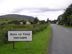 Children's burial ground in Baile Na BóChildren's burial ground · 1.6 mi
Explorer Tom Children's burial ground in Baile Na Bó is basically an overgrown corner of a cultivated field. There’s not a single…
 Faymore DolmenNamed dolmen · 1.6 mi
Explorer Tom Faymore Dolmen sits right on the roadside with its big capstone perched proudly on upright stones. I can’t find an…
 Muckish Mountain CairnCairn, unclassified · 1.6 mi
Explorer Tom Muckish Mountain Cairn is a 22-metre stone pile that practically shouts for attention from the mountain's lower edge.…
 Saint Michael's Catholic ChurchChurch/chapel · 2.1 mi
Explorer Tom Saint Michael's Catholic Church is a fan-shaped modern masterpiece from 1971 that looks like it was grown out of the…
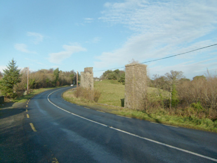 Faymore ViaductViaduct · 2.2 mi
Explorer Tom Faymore Viaduct has squared and snecked stonework with drafted margins to its corners. Built around 1903, it looks like…
More archaeology and monuments in County Donegal · All of County Donegal

What do you know about this place?Tap to add a comment or ask a question