What is recorded here
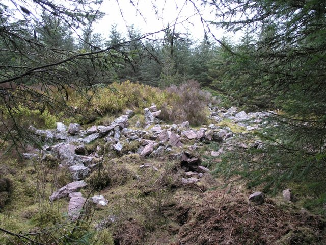
Three stones on the north, one on the south, and a lonely marker further west still outline a chamber no wider than a person stretched out. The forest has strangled the rest, leaving only this thin skeleton on an east-facing slope above a narrow valley. It may be the last breath of a megalithic tomb, but so little remains that even certainty must back away.
In forest on E-facing slope, in headwaters of narrow valley of tributary of River Blackwater. Monument is very ruined due to forest planting. Remains of possible chamber (Wth c. 1m), aligned E-W, represented by three contiguous uprights (c. 0.45m-0.9m H) on N side and single upright (0.5m H) on S side. Further upright stone (0.4m H) stands 3.8m to W. Remains could well be last vestiges of megalithic tomb but insufficient survives to warrant acceptance.
The above description is derived from the published 'Archaeological Inventory of County Cork. Volume 4: North Cork' (Dublin: Stationery Office, 2000). In certain instances the entries have been revised and updated in the light of recent research.
Date of upload/revision: 14 January 2009
The monument record does not grant public access. Check the route and ask the landowner before entering private land.
- What survives
- Recorded monument
Places near here
 IndicatedKiln, lime · 1662 yd
 CarnCairn, unclassified · 1721 yd
 CorranMountain / peak · 1730 yd
 Cilll BhrannaChurch · 1.2 mi
 SeefinMountain / peak · 1.3 mi
 Folacht FiadhFulacht fia · 1.4 mi
 CastleCastle, tower house · 1.8 mi
 Killavuleen LOOPVisitor information · 2.3 mi
 Cave in BallymacmoyCave · 2.7 mi
 Killavullen CavesCave · 2.7 mi
 Castle (in Ruins)Castle, unclassified · 2.7 mi
 Priest's WoodForest · 3.0 mi
Other information
Photo: Credit not shown in the picture search · Rights wording not checked; contact us if this picture should be removed