
What is recorded here
In pasture, on the N side of a road running E-W that forms the townland boundary with Ballingarry. Graveyard (LI049-102---) and Tobereendoney holy well (LI049-101----) lie 9m to the N and 95m to the WNW, respectively. Annotated ‘Cromlech’ on historic OSi maps. In 1840 the Ordnance Survey recorded this monument as a ‘Druid’s Altar’ in the townland (OSNB Ballingarry Parish, 190). Lynch (1908, 223-224) described the monument as another ‘Cromleac close to Sliabh Riach, in the townland of Ballyfroota, not far from Duntryleague. This should rather be called the remains of a Cromleac, and stands on the side of a bye-road. It consists of only three stones as shewn in the photograph. The top stone was broken and is supported by a pier of rubble masonry. It was about 7 feet [2.13m] long by 2ft. 8in. [0.85m] wide, and about 7 inches [0.17m] thick. It stands about 3 feet [0.91m] over the ground. There is no doubt the stones are not now in their original position, it was probably disturbed in making the road. It is called "Clochavarra", but I could learn little more about it. These stones have been visited by people with pains in the back, to stoop under the covering stone being a cure; and perhaps it is to this charm we owe its repair, and the preservation of the monument in such an exposed situation.’ In 1838 the Ordnance Survey recorded the following about this burial ground also known as 'Clochan Varra' which was described as; 'Cloch a' Bhárraigh, Barry's Stone. Cloch often mean a stone building in this part of Ireland. Cloghavarra. The remains of an old burial ground' (OSNB Ballingarry Parish, 196).
Monument recorded by De Valera and Ó Nualláin (1982, 79) as consisting of; ‘a slab, broken into two pieces and resting above three upright slabs set parallel to each other. This object, which stands at a road-side fence, is reputed to have been used as a resting place for coffins on their way to a local graveyard' [LI049-102----]. The underside of the capstone at the W end which is now broken, has a deep cross with expanded terminals carved into the surface of the stone. The dating of this cross is uncertain but may be associated with graveyard (LI049-102----) located in field immediately to N.
Compiled by: Fiona Rooney
Revised by: Caimin O'Brien
Date of revised upload: 5 April 2022
The monument record does not grant public access. Check the route and ask the landowner before entering private land.
- What survives
- Recorded monument
Places near here
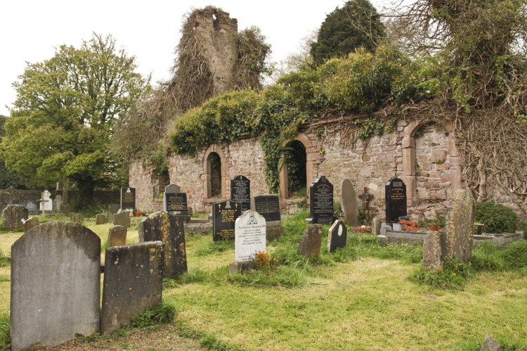 Grave YardBurial ground · 36 yd
 TobereendoneyHoly well · 107 yd
 bridgebridge · 660 yd
 Saint Patrick's Catholic Churchchurch/chapel · 1004 yd
 SlievereaghMountain / peak · 1.2 mi
 Saint Patrick's WellSpring · 1.6 mi
 Duntryleague - hachuredCastle, ringwork · 1.8 mi
 Edmund's WellSpring · 2.0 mi
 Ryves CastleCastle, unclassified · 2.3 mi
 Ballinvreena LoopVisitor information · 2.4 mi
 Darby's Bed Walk LoopWalking route · 2.7 mi
 Duntryleague HillMountain / peak · 2.7 mi
Other information
Photo: Credit not shown in the picture search · Rights wording not checked; contact us if this picture should be removed