What is recorded here
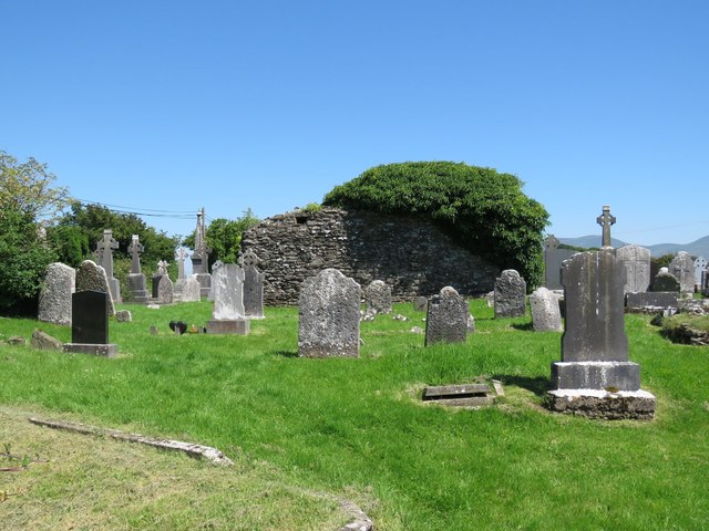
Ballingarry’s fairy fort is a raised oval platform, not a Norman mound, because excavation traced its growth from an Early Christian ringfort with low bank and outer fosse. People lived there intensively, rebuilt houses in layers, and left organic remains preserved enough to reveal domestic detail. The fort stood beside open grassland near Ballingarry church and graveyard, a small stronghold made strange by centuries of changing shape.
In reclaimed grassland, Ballingarry church and graveyard (LI049-107001-/002-) lie 135m to E. In 1840 the Ordnance Survey recorded this monument as a flat moat 23 paces in diameter at the top and about 10ft. [3m] above the level of the field’ (OSL, Vol. 1, 211). Depicted on the 1897 ed. OSi 25-inch map as a raised oval-shaped platform(dims. c. 25m N-S; 20m E-W) defined by a scarp, with fosse from S-W-NW. Recorded by Leask in 1938 (NMI topographical files) as a ‘flat topped fort 55 ft [16.76m], with site of a house 20’ [6.09m] x 9’ [2.74m]. Fosse toward the S’. Described by Hunt (1951, 73) as a ‘raised platform ringfort with fosse and Norman house site on top’. Excavated by Hunt in 1949, who summarised his results as following; ‘This year’s work gave additional confirmation that the structure was not, as its shape suggested, a Norman erection. Evidence of a number of superimposed buildings was found, and the several phases of the growth of the Down from a simple ringfort with low bank to its present Motte-like form, were traced. Section of the ground plans of several houses were revealed pointing to an intensive habitation from Early Christian times, and the former existence of a second and outer fosse was shown. A noteworthy feature of the excavation was the remarkable state of preservation of much of the organic material found' (Hunt 1951, 71-6). Earthwork visible as a raised oval-shaped platform defined by a fosse on Digital Globe orthoimage taken between 2011-13 and on Google Earth orthoimages.
See attached Google Earth orthoimages.
Compiled by: Fiona Rooney
Date of upload: 3 November 2021
The monument record does not grant public access. Check the route and ask the landowner before entering private land.
- What survives
- Recorded monument
Places near here
 Grave YardGraveyard · 204 yd
 St. Peters & St. Pauls WellHoly well · 358 yd
 Saint Patrick's Catholic Churchchurch/chapel · 484 yd
 bridgebridge · 803 yd
 SlievereaghMountain / peak · 1.2 mi
 Saint Patrick's WellSpring · 2.0 mi
 Duntryleague - hachuredCastle, ringwork · 2.0 mi
 Site of Castle, Castle FieldCastle, unclassified · 2.1 mi
 Edmund's WellSpring · 2.3 mi
 Ballinvreena LoopVisitor information · 2.6 mi
 Darby's Bed Walk LoopWalking route · 2.8 mi
 Duntryleague HillMountain / peak · 2.8 mi