What is recorded here
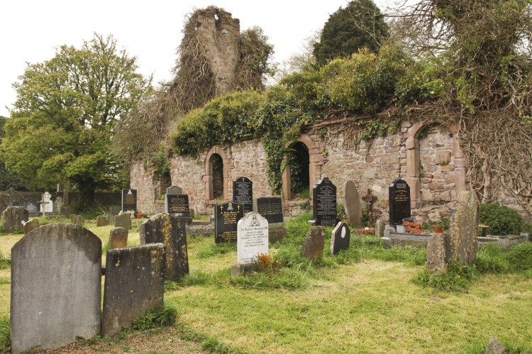
Graveyard depicted as a small circular shaped area shown with a dotted outline on the 1840 ed. OS 6-inch map. Depicted as an oval-shaped area (approx. dims. 26m N-S x 48m E-W) on the OS 25-inch map. No church site associated with this burial ground. Outline of levelled burial ground visible today on Digital Globe aerial photographs. Tobereendoney holy well (LI049-101----) 60m to W and Cromlech (LI049-103----) with cross-inscribed roof-stone immediately to S. In 1838 the Ordnance Survey recorded the following about this burial ground also known as 'Clochan Varra' which was described as; 'Cloch a' Bhárraigh, Barry's Stone. Cloch often mean a stone building in this part of Ireland. Cloghavarra. The remains of an old burial ground' (OSNB Ballingarry Parish, 196). The 'Clochan Varra' appears to be a reference to the roadside megalithic structure (LI049-103----).
Compiled by: Caimin O'Brien
Date of upload: 31 July 2019
A local ancient tomb; wider significance not recorded.
The monument record does not grant public access. Check the route and ask the landowner before entering private land.
- What survives
- Recorded monument
Places near here
 Megalithic structure in BallyfrootaMegalithic structure · 36 yd
 TobereendoneyHoly well · 95 yd
 bridgebridge · 674 yd
 Saint Patrick's Catholic Churchchurch/chapel · 1036 yd
 SlievereaghMountain / peak · 1.2 mi
 Saint Patrick's WellSpring · 1.6 mi
 Duntryleague - hachuredCastle, ringwork · 1.8 mi
 Edmund's WellSpring · 1.9 mi
 Ryves CastleCastle, unclassified · 2.3 mi
 Ballinvreena LoopVisitor information · 2.4 mi
 Darby's Bed Walk LoopWalking route · 2.7 mi
 Duntryleague HillMountain / peak · 2.7 mi
Other information
Photo: Credit not shown in the picture search · Rights wording not checked; contact us if this picture should be removed