What is recorded here
Pre-development excavation of part of a complex of curvilinear and linear features (DU005-057008-) identified from aerial photography uncovered seven Man-made underground passages between the south-west and south-east quadrants, while other features may have been the remains of Man-made underground passages. The Man-made underground passages had narrow passages and 1–2 circular chambers each. Where there was evidence of construction, the circular chambers (2.3–3m in diameter) were corbelled and were 1–2m in height. The passages were roofed with flat lintels. In some cases the Man-made underground passages coincided with the ditch and it was clear that they cut into ditch fill and were later than the ditches (Carroll 2008, 72).
Pre-development excavation of part of a complex of curvilinear and linear features (DU005-057008-) identified from aerial photography uncovered seven Man-made underground passages between the south-west and south-east quadrants, while other features may have been the remains of Man-made underground passages. The Man-made underground passages had narrow passages and 1–2 circular chambers each. Where there was evidence of construction, the circular chambers (2.3–3m in…
From the National Monuments Service (Archaeological Survey of Ireland) record DU005-013003
The monument record does not grant public access. Check the route and ask the landowner before entering private land.
- What survives
- Recorded monument
Places near here
Photo credits
- National Inventory of Architectural Heritage
- Jonjobaker, Wikimedia Commons · CC BY-SA 4.0
- Offdaw, Wikimedia Commons · CC BY-SA 4.0
- GsmithEIDW at English Wikipedia, Wikimedia Commons · Public domain
ExcavationExcavation, miscellaneous · 51 ydHilltop enclosure in RoseparkHilltop enclosure · 53 yd castle/fortified house243 ydSaint Peter's Church (Balrothery)Church/chapel · 262 ydBalrothery Heritage CentreMuseum · 263 ydFlat cemetery in DarcystownFlat cemetery · 275 ydBalrothery TowerCastle · 277 ydWavin LakesNature reserve · 1018 ydBarn WoodWood · 1601 ydCastle (remains of)Castle, tower house · 1602 ydArdgillan CastleHeritage attraction · 1.1 miBbq AreaPicnic place · 1.1 mi
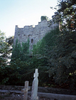 castle/fortified house243 yd
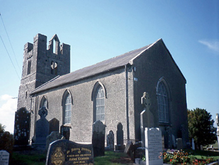 Saint Peter's Church (Balrothery)Church/chapel · 262 yd
 Balrothery Heritage CentreMuseum · 263 ydFlat cemetery in DarcystownFlat cemetery · 275 yd
 Balrothery TowerCastle · 277 ydWavin LakesNature reserve · 1018 ydBarn WoodWood · 1601 ydCastle (remains of)Castle, tower house · 1602 yd
 Ardgillan CastleHeritage attraction · 1.1 miBbq AreaPicnic place · 1.1 mi
More archaeology and monuments in County Dublin · All of County Dublin
What do you know about this place?