What is recorded here
The following description is derived from both the published 'Archaeological Inventory of County Louth' (Dublin: Stationery Office, 1986) and the 'Archaeological Survey of County Louth' (Dublin: Stationery Office, 1991). In certain instances the entries have been revised and updated in the light of recent research.
Date of upload/revision: 13 April 2012
Revised by: Claire Breen
Drystone-built Man-made underground passage consisting of a passage (L 5m, Wth 1.1m, H 1.2m) running E, then continuing E as an expanded gallery (L 5.5m). A drop-hole in the middle of the passage gives access to a second gallery (L 8.7m, Wth 1m, H 1.3m) running N. (CLAJ 1964, 317-20)
Large D-shaped enclosure (LH012-005001-) visible on OSi 2005 ortho photograph (http://maps.osi.ie/publicviewer/#V1,704905,804014,6,5 (Accessed 12 April 2012)). Circular depression (diam. c. 30m) visible on ortho photo in W half of enclosure possibly indicates part of this Man-made underground passage.
The monument record does not grant public access. Check the route and ask the landowner before entering private land.
- What survives
- Recorded monument
Places near here
 Enclosure in MullagharlinEnclosure · 64 yd
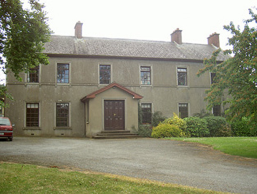 Mullaharlin Househouse · 122 yd
 Fulacht fia in CrumlinFulacht fia · 563 yd
 Saint Fursey's Catholic Churchchurch/chapel · 860 yd
 CastleCastle, unclassified · 1562 yd
 IndicatedCastle, unclassified · 1.0 mi
 BallybarrackMountain / peak · 1.2 mi
 Broad WoodForest · 1.6 mi
 Long WoodForest · 1.7 mi
 Photo GalleryHeritage attraction · 1.9 mi
 Dundalk CentralHeritage attraction · 1.9 mi
 Bombing 1975Memorial · 2.0 mi