
What is recorded here
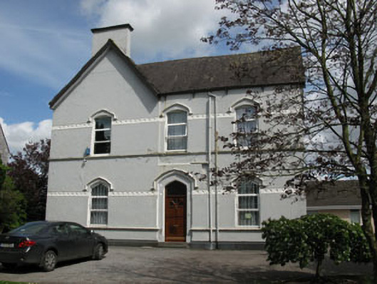
Late 18th/early 19th-century 2-storey L-shaped house. Front elevation (S) of 4 bays, off-centre porch entrance; Wyatt windows in side bay to W, remainder sash windows. Gabled addition to rear on W side makes ground plan L-shaped. Shallow central gabled stairway projection to rear. Farmbuildings and cobbled yard to rear. Walled garden to S.
The above description is derived from the published 'Archaeological Inventory of County Cork. Volume 3: Mid Cork' (Dublin: Stationery Office, 1997). In certain instances the entries have been revised and updated in the light of recent research.
Date of upload/revision: 14 January 2009
The monument record does not grant public access. Check the route and ask the landowner before entering private land.
- What survives
- Recorded monument
Places near here
 Church in BallynoraChurch · 686 yd
 Habitation site in Curraheen (cork By., Inishkenny Par.)Habitation site · 988 yd
 Fulacht fia in CarrigrohaneFulacht fia · 1102 yd
 Ballincollig Castle (in Ruins)Castle, tower house · 1305 yd
 Cave in Ballincollig (muskerry East By., Carrigrohane Par.)Cave · 1311 yd
 Ballincollig CastleCastle · 1315 yd
 Ballincollig Presbyterypresbytery/parochial/curate's house · 1427 yd
 Sunday WellSpring · 1446 yd
 Patrick BurnsMemorial · 1719 yd
 Graveyard in BallynoraGraveyard · 1.6 mi
 Stone BeachBeach / strand · 1.6 mi
 waterfallVisitor information · 1.8 mi
Other information
Photo: Credit not shown in the picture search · Rights wording not checked; contact us if this picture should be removed