
What is recorded here
From OpenStreetMap (© OpenStreetMap contributors) n3804704367
Places near here
Photo credits
- Kenneth Allen, Wikimedia Commons · CC BY-SA 2.0
- Robert Bone, Wikimedia Commons · CC BY-SA 2.0
- National Inventory of Architectural Heritage
- Maker not stated on source page, commons.wikimedia.org
- Ian Paterson, Wikimedia Commons · CC BY-SA 2.0
- John Cromie, Geograph · CC BY-SA 2.0
- Maker not stated on source page, www.pinterest.com
- Jonathan Wilkins, Wikimedia Commons
 Stone cairn, LougherrigPublicly named cairn · 1.2 mi
Explorer Tom Stone cairn, Lougherrig is a simple name for what might be one of the oldest quiet spots in County Donegal. There’s no…
 Giant's Grave Megalithic TombMegalithic tomb · 1.3 mi
Explorer Tom Giant's Grave Megalithic Tomb lies deep in boggy ground between Aghla and Scraigs. The recorded gallery was five metres…
 lime kiln1.5 mi
Explorer Tom Lime kiln in Meentymorgal was built c.1880 with an earth embankment behind it for loading crushed limestone. I reckon…
 Fintown Old Burial GroundBurial ground · 1.5 mi
Explorer Tom Fintown Old Burial Ground sits in a marshy, hummocky field covered in heather. There are zero burial markers to prove…
 ScraigsMountain / peak · 2.0 mi
Explorer Tom Scraigs is a mountain / peak in County Donegal hiding a treasure that is definitely just an old biscuit tin. Legend…
 Aghla MountainMountain / peak · 2.6 mi
Explorer Tom Aghla Mountain would want 'Finally Rested' on its tombstone because it’s been holding up the sky for way too long…
 Aghla Mountain South TopMountain / peak · 2.9 mi
Explorer Tom Aghla Mountain South Top in Donegal claims there’s a shortcut, but it’s really just a fancy way of saying 'good luck…
 Cairn, Coolvoy, DoocharyPublicly named cairn · 3.1 mi
Explorer Tom Cairn, Coolvoy, Doochary is a name that sounds like it belongs to a place with a lot of local history and stories. I…
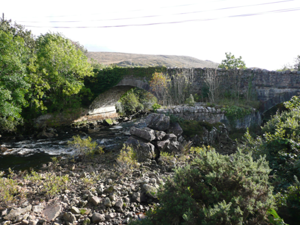 Doochary BridgeBridge · 3.2 mi
Explorer Tom Doochary Bridge would order the biggest chipper in Donegal and claim he ate every single one by himself last Tuesday.…
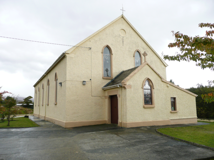 Saint Conal's Catholic ChurchChurch/chapel · 3.2 mi
Explorer Tom Saint Conal's Catholic Church was built in 1833 and altered in 1913. Its pointed windows, stained glass and timber…
 Megalithic structure in Clochar An ChuilinnMegalithic structure · 3.2 mi
Explorer Tom Megalithic structure in Clochar An Chuilinn is just a massive slab propped up on rocks. Some archaeologists are still…
 Slí Na Finne - Sli Dhun na nGallWalking route · 4.9 mi
Explorer Tom Slí na Finne is Donegal walking on a grand scale: a circuit through Lough Finn country where mountains, wet ground and…
More mountains and hills in County Donegal · All of County Donegal

What do you know about this place?Tap to add a comment or ask a question