
What is recorded here
From the National Monuments Service (Archaeological Survey of Ireland) record DG066-001
Places near here
Photo credits
- Ian Paterson, Wikimedia Commons · CC BY-SA 2.0
- National Inventory of Architectural Heritage
- Robert Bone, Wikimedia Commons · CC BY-SA 2.0
- Kenneth Allen, Wikimedia Commons · CC BY-SA 2.0
- Kenneth Allen, Geograph · Creative Commons Attribution-ShareAlike 2.0
- John Cromie, Geograph · CC BY-SA 2.0
- Jonathan Wilkins, Wikimedia Commons
 ScraigsMountain / peak · 1603 yd
Explorer Tom Scraigs is a mountain / peak in County Donegal hiding a treasure that is definitely just an old biscuit tin. Legend…
 lime kiln1.2 mi
Explorer Tom Lime kiln in Meentymorgal was built c.1880 with an earth embankment behind it for loading crushed limestone. I reckon…
 Giant's Grave Megalithic TombMegalithic tomb · 1.5 mi
Explorer Tom Giant's Grave Megalithic Tomb lies deep in boggy ground between Aghla and Scraigs. The recorded gallery was five metres…
 Stone cairn, LougherrigPublicly named cairn · 2.6 mi
Explorer Tom Stone cairn, Lougherrig is a simple name for what might be one of the oldest quiet spots in County Donegal. There’s no…
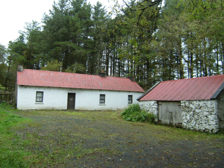 farmyard complex2.9 mi
Explorer Tom Farmyard complex in Largnalarkan hides metal pegs in its eaves, leftovers from a roped thatched roof. Built c.1830, it…
 Kingarrow National SchoolSchool · 3.2 mi
Explorer Tom Kingarrow National School wears its 1891 date on a plaque and leaves the ends of its roof rafters in view. It kept its…
 Aghla MountainMountain / peak · 3.2 mi
Explorer Tom Aghla Mountain would want 'Finally Rested' on its tombstone because it’s been holding up the sky for way too long…
 Aghla Mountain South TopMountain / peak · 3.5 mi
Explorer Tom Aghla Mountain South Top in Donegal claims there’s a shortcut, but it’s really just a fancy way of saying 'good luck…
 Slí Na Finne - Sli Dhun na nGallWalking route · 3.5 mi
Explorer Tom Slí na Finne is Donegal walking on a grand scale: a circuit through Lough Finn country where mountains, wet ground and…
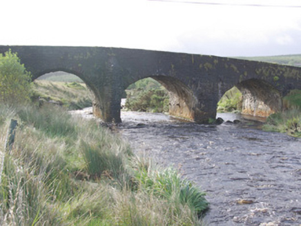 Cummirk BridgeBridge · 4.0 mi
Explorer Tom Cummirk Bridge has three arches that are spaced out so weirdly they look confused about which way is left. The whole…
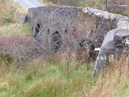 Droichead na Comairce [Cummirk Bridge]Bridge · 4.0 mi
Explorer Tom Droichead na Comairce [Cummirk Bridge], built c.1810, arches over the river like a stone trinity that forgot to pray…
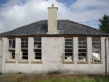 school4.2 mi
Explorer Tom School in Letterbrick is out of use but still listening through its walls for any whisper about who left the chalk on…
More archaeology and monuments in County Donegal · All of County Donegal

What do you know about this place?Tap to add a comment or ask a question