Places near here
Photo credits
- National Inventory of Architectural Heritage
- Kenneth Allen, Geograph · CC BY-SA 2.0
- Ian Paterson, Wikimedia Commons · CC BY-SA 2.0
- Richard Webb, Geograph · CC BY-SA 2.0
- Robert Bone, Wikimedia Commons · CC BY-SA 2.0
- Kenneth Allen, Wikimedia Commons · CC BY-SA 2.0
- Patrice78500, Wikimedia Commons · Public domain
- Dr Neil Clifton, Geograph · CC BY-SA 2.0
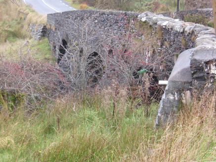 Droichead na Comairce [Cummirk Bridge]Bridge · 377 yd
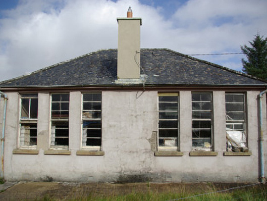
Explorer Tom Droichead na Comairce [Cummirk Bridge], built c.1810, arches over the river like a stone trinity that forgot to pray for better parking. I bet the adjacent ruined school used to watch boats float through those three doors just to escape the homework.
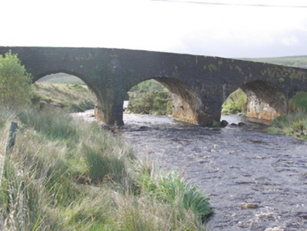 Cummirk BridgeBridge · 377 yd
Explorer Tom Cummirk Bridge has three arches that are spaced out so weirdly they look confused about which way is left. The whole parish argued for weeks over whether it was safe, then everyone agreed it was probably fine. Wave to the stone and let the water keep its secrets to itself.
 Teach Tábhairne an RileánPub · 3.3 mi
Explorer Tom Teach Tábhairne an Rileán in County Donegal has a mouthful of a name. Say it three times fast for me and tell me how you feel! Bring your worst joke, the place has heard worse.
 ScraigsMountain / peak · 4.0 mi
Explorer Tom Scraigs is a mountain / peak in County Donegal hiding a treasure that is definitely just an old biscuit tin. Legend says it’s full of gold, but I’m sure it’s actually stale digestive biscuits and regret. Still worth checking out if you’re feeling a bit nostalgic for snacks. Get a photo with it before it gets a better agent.
 Gaugin MountainMountain / peak · 4.3 mi
Explorer Tom Gaugin Mountain stands at 595 meters on the northern fringe of the Bluestacks, guarding a cairn and a tattered football flag. It looks like it has been waiting since the 2012 All Ireland victory for someone to replace that rag with something less prone to shredding in the wind.
 Giant's Grave Megalithic TombMegalithic tomb · 5.3 mi
Explorer Tom Giant's Grave Megalithic Tomb lies deep in boggy ground between Aghla and Scraigs. The recorded gallery was five metres long, with six stones on each side. A slab across one end might not have been part of its original roof. That uncertainty is more interesting than pretending the wet ground offers an easy look inside.
 Stone cairn, LougherrigPublicly named cairn · 6.8 mi
Explorer Tom Stone cairn, Lougherrig is a simple name for what might be one of the oldest quiet spots in County Donegal. There’s no date attached to it, which means it could be as old as time itself or just a very stubborn pile. I’d like to know if it ever gets tired of being a landmark.
 Páirc Naisiúnta Ghleann Bheatha - Glenveagh National ParkNature reserve · 8.6 mi
Explorer Tom I spotted a golden eagle and immediately pretended it had come to inspect me. Glenveagh National Park spreads across roughly 170 square kilometres of Donegal, which makes any plan to see it all before lunch a fine piece of nonsense. Lough Veagh runs through the glen, mountains rise around it, and red deer move through the wider country. Golden eagles were reintroduced here in 2000, a bold return for a bird once lost from the region. This landscape also carries the history of the Derryveagh Evictions, when 224 people were driven from the estate in 1861; the views cannot be separated from that record. The deer have better routes through this country than any shortcut I could invent. Later owner Henry McIlhenny gave the estate to the Irish state in the 1970s. Public park paths offer different lengths of walk, while castle tours have separate arrangements, so check routes and weather before setting off. Choose one stretch of glen and let it be enough; the mountain will still be here for the next visit.
 Newmills Corn and Flax MillsHeritage attraction · 8.9 mi
Explorer Tom Newmills Corn and Flax Mills has a waterwheel big enough to make me stop and watch the machinery do the hard work. Corn and flax kept different trades moving here. Heritage Ireland's 2026 visitor season has ended, so I would check the next opening date before making the trip.
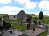 Stackarnagh Abbey GraveyardGraveyard · 9.2 mi
Explorer Tom Stackarnagh Abbey Graveyard has a gatepost detail I keep coming back to: a reused window fragment carved with a fish biting the end of a moulding, with a rough unicorn above it. The survey says the stone probably came from the church's ruined south window. I can enjoy the odd pair without inventing what the medieval carver meant.
 Battle of ScarrifholisBattle · 9.3 mi
Explorer Tom Battle of Scarrifholis in County Donegal would walk into any job interview and say it has excellent conflict resolution skills, despite mostly just standing around looking confused while cannons went off. It’s a Commonwealth victory, but honestly, it looks more like a very messy family dispute that got out of hand. Tell the kids it's a castle. Close enough.
 Wilkin's of Church HillPub · 9.6 mi
Explorer Tom Wilkin's of Church Hill in County Donegal sounds like it's guarded by an angel who demands tips for listening to your problems, which is fair enough. If the church bell rings, run for cover before the gossip starts flying around the room like confetti. Bring the dog, it'll have opinions.
More historic places in County Donegal · All of County Donegal

What do you know about this place?Tap to add a comment or ask a question