
What is recorded here
On W side of main street in Buttevant town (14631). Small rectangular tower (5m N-S; 4m E-W), standing to two storeys, with wall (L 15.2m) extending S from midway along S face of tower. This wall forms E wall of rectangular structure; S wall (L 8.2m) and return of W wall (L 5.6m) also survive. Only S half of…
Read the whole record
From the National Monuments Service (Archaeological Survey of Ireland) record CO017-053002
Places near here
Photo credits
- National Inventory of Architectural Heritage
- Kieran Hynes, Wikimedia Commons · CC BY-SA 2.0
- Christian Pirkl, Wikimedia Commons · CC BY-SA 3.0 at
- David P Howard, Geograph · CC BY-SA 2.0
- Mike Searle, Geograph · CC BY-SA 2.0
- Happyrains4118, Wikimedia Commons · CC BY-SA 4.0
- Sitomon, Wikimedia Commons · CC BY-SA 2.0
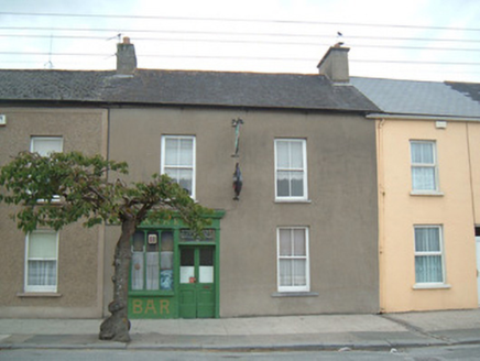 Maureen'sHouse · 42 yd
Explorer Tom Maureen’s in Buttevant is strutting down Richmond Street, looking absolutely smug in its traditional shopfront. It’s got that charm thing going on, which is annoyingly effective. Bring sandwiches and a sense of wonder.
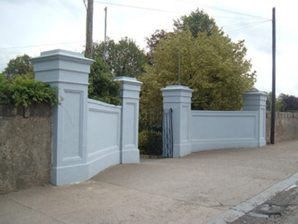 Convent of MercyGazebo · 76 yd
Explorer Tom Convent of Mercy in Buttevant is actually a gazebo with stained glass that adds visual interest to the complex. It’s unusual in form and surrounded by boundary walls that exhibit good craftsmanship. Make up your mind if you’re going to be holy or just enjoy the view from the piers, it’s a tough choice.
Town defences in ButtevantTown defences · 123 ydExplorer Tom Town defences in Buttevant are mostly gone, but records suggest rectangular circuits enclosing 5 to 15 hectares. Nothing visible remains now, just the memory of a North Gate from 1375. A bit of a mystery spot.
.jpg/250px-Buttevant_Barry_Castle_(geograph_2335827).jpg "Photo: Kieran Hynes, Wikimedia Commons · CC BY-SA 2.0") Buttevant Castle (in Ruins)Castle · 281 yd
Buttevant Castle (in Ruins)Castle · 281 ydExplorer Tom Buttevant Castle in County Cork is basically a fancy pile of rocks. The account says 'in ruins,' which just means it's had a bad day. Show me what's left of the drama!
Charles BunworthMemorial · 359 yd Sycamore504 yd
Explorer Tom Sycamore in County Cork caused the whole parish to argue for a week over which side is prettier. Bring your nan, she'll know more than me and probably start shouting.
David HurleyMemorial · 505 yd TowerDovecote · 1279 yd
Explorer Tom Dovecote in Ballybeg East is full of pigeon holes stacked up to the ceiling. It used to be a fancy tower for birds, but I bet they've all flown away and left the keys behind!
 Templeconnell Castle (in Ruins)Castle, tower house · 2.2 mi
Explorer Tom Templeconnell Castle is a five-storey tower that looks like it went to war with gravity and lost slightly. The Percivals took over in 1656 after the Magners got tired of the drama. A good place to forget your phone for ten minutes and feel ancient.
Smith's WellSpring · 3.4 mi Doneraile HouseHeritage attraction · 3.8 mi
 European Yew3.9 mi
Explorer Tom European Yew here would post a very dry, sarcastic caption if it had social media: 'Still standing, unlike my ex.' It's got that unbothered energy down to an art form. Bring sandwiches, the gulls will think you're feeding them.
More castles and forts in County Cork · All of County Cork

What do you know about this place?Tap to add a comment or ask a question