
What is recorded here
From the National Monuments Service (Archaeological Survey of Ireland) record TN021-064
Places near here
Photo credits
- National Inventory of Architectural Heritage
- Kmcnamee, Wikimedia Commons · CC BY-SA 4.0
- Maker not stated on source page, en.wikipedia.org
- Maker not stated on source page, heritageireland.ie
- Maker not stated on source page, www.tuatha.ie
- Andreas F. Borchert, Wikimedia Commons · CC BY-SA 4.0
- Maker not stated on source page, commons.wikimedia.org
- Mike Searle, Wikimedia Commons · CC BY-SA 2.0
- Maker not stated on source page, www.pinterest.com
- Maker not stated on source page, www.dreamstime.com
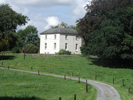 Riverglebe HouseRectory/glebe/vicarage/curate's house · 1412 yd
Explorer Tom Riverglebe House in Coolkereen had a solid escape plan involving its decorative fanlight and timber sash windows back…
 rectory/glebe/vicarage/curate's house1523 yd
Explorer Tom Rectory in Killeisk has a secret it would tell after three pints, probably about who actually built that fancy…
 St. Michael's Park, ToomevaraGAA ground · 1580 yd
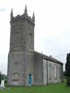 Toomyvara Church (Aghnameadle)Church/chapel · 1.1 mi
Explorer Tom Toomyvara Church would review its visitors as 'adequate, but please stop touching the carved limestone surrounds' if it…
 Church, GraveyardChurch · 1.1 mi
Explorer Tom Church and Graveyard in Coolkereen is having a massive grudge match against the Rock of Cashel, screaming that it’s got…
 AbbeyReligious house, Augustinian friars · 1.2 mi
Explorer Tom Abbey in Castlequarter is playing party pooper. It’s an Augustinian priory that claims it was founded way back after…
 Memorial stone in Bunacum,castlequarter (aghameadle Par.)Memorial stone · 1.2 mi
Explorer Tom Memorial stone in Bunacum, Castlequarter is doing a bit of a ghostly impression at night. It's right next to the old…
 Saint Joseph's Catholic ChurchChurch/chapel · 1.2 mi
Explorer Tom Saint Joseph's Catholic Church in Castlequarter has a stained-glass window signed by Earley from 1933, which is a bit…
 Knockane Castle (in ruins)Castle, tower house · 1.4 mi
Explorer Tom Knockane Castle in Knockane has been feuding with the rain for centuries, mostly because it keeps getting wet and…
 Knockane CastleCastle · 1.4 mi
Explorer Tom Knockane Castle in County Tipperary refuses to fall down purely out of spite, likely because it knows you’re watching…
 Ballinree CemeteryCemetery · 1.6 mi
Explorer Tom Ballinree Cemetery was built on a bargain where someone traded their first-born child for a really good view. The…
 Fairy fort / earthen ringfort in Grenanstown (kilkeary Par.)Fairy fort / earthen ringfort · 1.9 mi
Explorer Tom Fairy fort / earthen ringfort in Grenanstown is stuck in a feud with its neighbor over who gets the best view of the…
More archaeology and monuments in County Tipperary · All of County Tipperary

What do you know about this place?Tap to add a comment or ask a question