Places near here
Photo credits
- National Inventory of Architectural Heritage
- Kenraiz, Wikimedia Commons · CC BY-SA 3.0
- Kenneth Allen, Wikimedia Commons · Creative Commons Attribution-ShareAlike 2.0
- Alvesgaspar, Wikimedia Commons · CC BY-SA 3.0
- Kenneth Allen, Geograph · CC BY-SA 2.0
- Fifiheavey, Wikimedia Commons · CC BY-SA 4.0
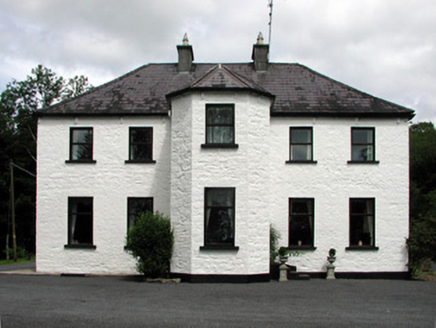 Corduff HouseHouse · 1016 yd
Explorer Tom Corduff House overlooks the lough like it’s judging your life choices from up high. A hero nobody remembers saved it from collapse in 1902, allegedly with a stick. Bring a pen pal to tell them about it.
LisroughtyFairy fort / earthen ringfort · 1348 ydExplorer Tom Lisroughty is locked in a bitter feud with the village next door over something incredibly daft. This grassy ring sits right beside a stream, looking slightly offended at the whole situation. Perfect spot to practise your best tour-guide voice right now.
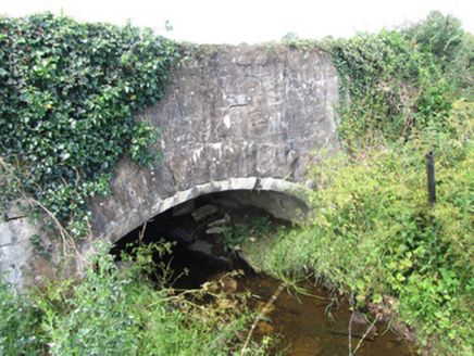 County BridgeBridge · 1727 yd
Explorer Tom County Bridge in Cornagunleog is an eighteenth-century storyteller that only reveals its secrets after three pints of stout. It’s made of rubble stone and looks like it’s seen some things. Pour one out for it.
 Black Poplar2.1 mi
Explorer Tom Black Poplar was designed by a mother-in-law who wanted something tall but structurally insecure. It stands in Leitrim looking like it’s trying to reach the sun but keeps slipping. Stick around for the light changing, it's a show.
CastleCastle, ringwork · 2.2 miExplorer Tom Castle in Woodford Demesne was an O’Rourke centre where the escape plan involved rowing away quickly. It’s now just a ringwork hiding in the woods by the canal. Ring your granny and tell her where you are.
Cherry IslandIslet · 2.2 miExplorer Tom Cherry Island in County Leitrim is cursed by anyone who doesn’t wave at it with enough enthusiasm, or so the legend goes that I just invented for fun. It’s probably waiting for you to greet it like an old friend before it decides to stop being a bit smug about its name. Bring sandwiches, the gulls will thank you.
DrumgownaghMountain / peak · 2.3 miExplorer Tom Drumgownagh had a moment of fame once when a famous actor mistook it for a different mountain and filmed a scene. The locals still pretend they don't know him to this very day. Best enjoyed with a bag of chips and no plans.
 IndicatedCastle, tower house · 2.3 mi
Explorer Tom Castle in Ballymagauran writes on its dating profile: 'Two stories tall, good bones, need a roof'. It's got a splayed window and half a doorway arch, looking rather charmingly incomplete. Pop by and tell it it's looking well.
DerrinivverMountain / peak · 2.5 miExplorer Tom Derrinivver was built on a bargain where the devil promised good views in exchange for your ability to spell your own name correctly. Most people have lost that bet, which explains why everyone stumbles over their words here. If it rains, blame me.
 Common Lime2.6 mi
Explorer Tom Common Lime in County Cavan has a name that really means 'The Tree That Judges Your Posture' if you ask me. I made that up, but it feels right given how straight its trunk is. A proper spot for a flask of tea and a big think about your life choices.
 Killycluggin StoneVisitor information · 4.2 mi
Explorer Tom Killycluggin Stone in County Cavan makes a spooky knocking sound at night that is definitely just the wind being rude. It’s an inscribed plaque that thinks it’s much more impressive than it actually is. Wave at the cows, they're the real locals.
 Graveyard5.7 mi
Explorer Tom Graveyard in Commons sits right next to a massive church, but it has this prophecy that the ground would swallow the whole village if anyone danced there on a full moon. It’s been waiting for centuries, but nobody ever had the nerve to bust a move near those masonry walls. Stand where the owner stood and practise looking smug.
More archaeology and monuments in County Leitrim · All of County Leitrim

What do you know about this place?Tap to add a comment or ask a question