
What is recorded here
From the National Monuments Service (Archaeological Survey of Ireland) record CO032-046
Places near here
Photo credits
- Maker not stated on source page, www.tripadvisor.ca
- Maker not stated on source page, pixabay.com
- Maker not stated on source page, www.hillwalktours.com
- National Inventory of Architectural Heritage
- Maker not stated on source page, www.youtube.com
- Mike Searle, Wikimedia Commons · CC BY-SA 2.0
- Cantoo, Geograph · CC BY-SA 2.0
- Chani Anderson / The Echo, www.echolive.ie
 Church in KilcranathanChurch · 700 yd
Explorer Tom Church in Kilcranathan is guarded by a bird that absolutely refuses to leave the four grass mounds. The locals say it’s…
 Church in KilgobbanChurch · 1280 yd
Explorer Tom Church in Kilgobban is just grass-covered mounds pretending to be holy ground. Locals swear by a superstition involving…
 Standing stone in Moanroe (duhallow By.)Standing stone · 1410 yd
Explorer Tom Standing stone in Moanroe is one of four that got broken and removed years ago. Exact location unknown, so good luck…
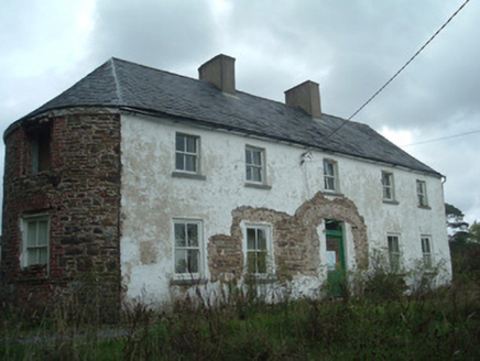 Clover HillHouse · 1584 yd
Explorer Tom Clover Hill in Gortnagross is hiding its bowed ends behind some serious recessed site energy. It’s got timber sash…
 Enclosure in BallynafeahaEnclosure · 1.0 mi
Explorer Tom Enclosure in Ballynafeaha thinks tourists from Dublin are all talk and no walk. It’s just a cropmark in a tillage…
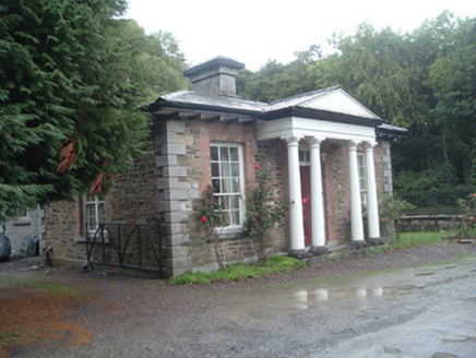 Longueville HouseGate lodge · 1.1 mi
Explorer Tom Longueville House gate lodge in Ballynafeaha claims Queen Victoria visited twice to check on her tea leaves, and since…
 Longueville House HotelDemesne walls/gates/railings · 1.1 mi
Explorer Tom Longueville House Hotel’s entrance gateway is showing off its blacksmith skills like it invented fire. It’s an…
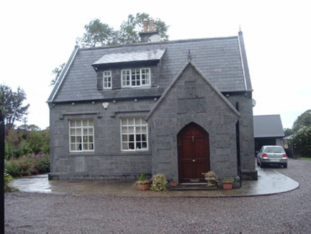 Longueville SchoolSchool · 1.1 mi
Explorer Tom Longueville School in Kilgobban dates from 1890 and has gabled porches on both ends. It was dedicated to Richard…
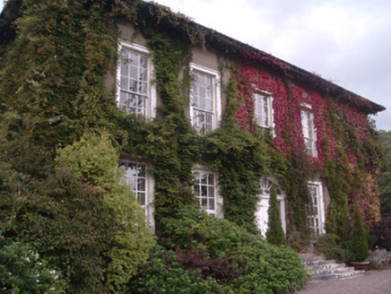 Eden HillCountry house · 1.2 mi
Explorer Tom Eden Hill in Gortnagross is definitely run by a dog who thinks he owns the whole River Blackwater valley. He sits on…
 Dromaneen CastleHeritage attraction · 1.7 mi
Explorer Tom Dromaneen Castle in County Cork is hidden by trees because the map makers were too lazy to walk the extra ten yards to…
 CastleBawn · 1.7 mi
Explorer Tom Castle bawn in Ballyclogh had a bishop who refused to visit because he didn't like the way the walls were aligned with…
 Dr Croke Park, BallycloughGAA ground · 2.0 mi
More archaeology and monuments in County Cork · All of County Cork

What do you know about this place?Tap to add a comment or ask a question