
Places near here
Photo credits
- National Inventory of Architectural Heritage
- Mike Searle, Geograph · CC BY-SA 2.0
- DanielecDalton, Wikimedia Commons · CC BY-SA 4.0
- Willow, Wikimedia Commons · CC BY 2.5
- Andreas F. Borchert, Wikimedia Commons · CC BY-SA 4.0
- Mike Searle, Wikimedia Commons · CC BY-SA 2.0
- ClintMalpaso, Wikimedia Commons · CC BY-SA 3.0
- Enda O Flaherty, Geograph · CC BY-SA 2.0
- Sheila Russell, Wikimedia Commons · CC BY-SA 2.0
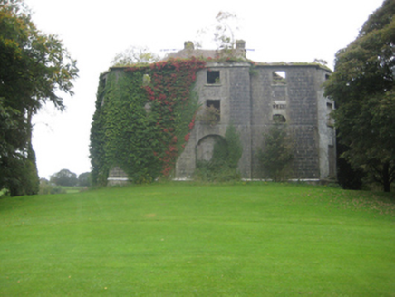 Dunmore HouseCountry house · 2.1 mi
 Country house in Dunmore DemesneCountry house · 2.1 mi
Explorer Tom Country house in Dunmore Demesne is playing hard to get. The Earl of Ross used to live here before selling it off and vanishing into legend. Stand on the spot and imagine the gossip it's heard from the golfers.
 Brownnsgrove HouseDemesne walls/gates/railings · 2.1 mi
Explorer Tom Brownnsgrove House would be the uncle at the wedding who thinks he’s the best man, standing right there in its stone glory. The gates are so ornate they probably have their own fan club. It’s freezing cold out here, but that stonework is absolutely warm to the eye.
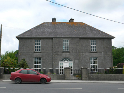 Merton HousePresbytery/parochial/curate's house · 2.2 mi
Explorer Tom Merton House’s first owner had an escape plan involving a goat and a very narrow gap in the wall. Now it just stands there on High Street with its fancy limestone, looking down on anyone who walks past without a hat. Bring your own legend
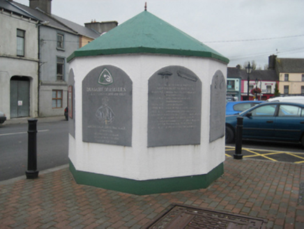 weighbridge/weighhouse2.3 mi
Explorer Tom Weighbridge or weighhouse in Dunmore is sitting there looking confused because nobody buys bulk goods anymore or cares about its impartial measurements. It would post a selfie complaining about the lack of engagement on social media if it had thumbs. Have a look and decide if it’s worth your time today.
 Dunmore CastleCastle · 2.5 mi
 European ash6.2 mi
 Cloigtheach (Round Tower)Round tower · 6.2 mi
Explorer Tom Cloigtheach (Round Tower) in Pollacorragune is standing guard like a very tired bouncer. It's got a high doorway because apparently nobody walks anymore. Ring your granny and tell her where you are before you get lost.
 Fartamore Castle in ruinsCastle, tower house · 6.2 mi
Explorer Tom Fartamore Castle in ruins has a family tree that’s mostly made up, but the name does suggest some serious flatulence history. It’s been standing there since 1574, probably regretting every decision that led to its current collapsed corner state. Ideal place to rehearse an excuse for being late.
 St. Marys CathedralCathedral · 6.3 mi
Explorer Tom St. Marys Cathedral in Tuam has lost its nave to fire but kept the chancel. It’s basically a fancy porch with attitude and a barrel vault. Have a chat with it, nobody's watching.
 KnockmaaWood · 11 mi
 Brigit's GardenVisitor attraction · 23 mi
More archaeology and monuments in County Galway · All of County Galway

What do you know about this place?Tap to add a comment or ask a question