Places near here
Photo credits
- National Inventory of Architectural Heritage
- Allie_Caulfield from Germany, Wikimedia Commons · CC BY 2.0
- abdallahh from Montréal, Canada, Wikimedia Commons · CC BY 2.0
- Kenneth Allen, Geograph · CC BY-SA 2.0
- Kenneth Allen, Wikimedia Commons · CC BY-SA 2.0
- Andreas F. Borchert, Wikimedia Commons · CC BY-SA 3.0 de
- Raymond Okonski, Wikimedia Commons · CC BY-SA 2.0
- Brian Lenehan, Geograph · CC BY-SA 2.0
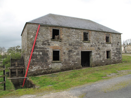 mill (water)750 yd
Explorer Tom Mill in Teraverty hums a song called 'Grind Grind Grind' because that’s all it ever did until 1966. It’s still got its water wheel, which is basically a giant fan for dust. Wave at the cows, they’re the only ones who remember the flour.
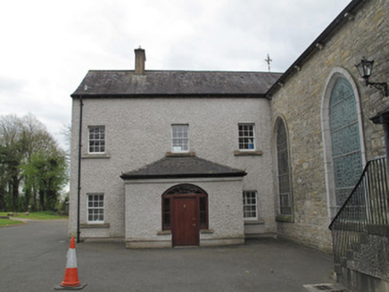 Saint Mary's Catholic ChurchPresbytery/parochial/curate's house · 769 yd
Explorer Tom Saint Mary’s Catholic Church in Drumdesco holds a fake world record for being the chattyest church annex ever built. It’s stuck to its parish like glue, which is rude but effective. Tell the kids it’s a castle.
LisleaghanFairy fort / earthen ringfort · 855 ydExplorer Tom Corcreeghagh is basically a giant mud pie that got tired and just sat down on top of a hill. It’s got a stone-clad edge like it was trying to impress the neighbors with some fancy masonry, but honestly, it looks more like a hedgehog rolled in gravel. Pack a picnic and an excuse for why you’re standing there looking at dirt.
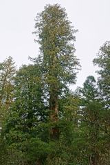 Coast Redwood1544 yd
Explorer Tom Another Coast Redwood in Monaghan is currently judging every rabbit that passes by for wearing mismatched socks. It thinks they’re all fashion disasters. Bring a friend who talks too much and let the place shut them up.
 Western Redcedar1554 yd
Explorer Tom A Western Redcedar here is currently having a dramatic falling-out with the nearest oak tree over who has better bark. It’s getting very emotional about it. A proper spot for a flask of tea and a big think.
Rough HillMountain / peak · 2.4 miExplorer Tom Rough Hill is where a fiddler played so loudly all night that the grass grew back in the shape of a furious eyebrow. The locals say the hill still hums when you listen closely, mostly out of sheer annoyance at having been used as a stage. It's free, it's odd, what more do you want?
 Sliabh Beagh Hotel and Tourism CentreVisitor information · 3.7 mi
Explorer Tom Sliabh Beagh Hotel and Tourism Centre thinks Dublin tourists are just fancy versions of tourists, which is technically true but rude. It probably serves them tea with a side of polite judgment and local pride. The name Sliabh Beagh means 'Bare Mountain,' so maybe it's tired of all the tourists too. Make a wish for better weather; it's had centuries of practice at failing.
 Peter's LakePark · 3.8 mi
Explorer Tom Peter's Lake in County Monaghan is sick of people asking if it’s deep or if there are fish in it. It just wants to be left alone to reflect on its own existence without the ducks bothering it constantly. Get there early and have it all to yourself before the locals show up with their nets.
 Monaghan County MuseumMuseum · 3.9 mi
Explorer Tom Monaghan County Museum is being bought by a cow that thinks it has better taste in local history than anyone else does. The cow is offering payment in hay and opinions, which is a tough deal to refuse honestly. Bring curiosity, leave with a better story than mine to tell your mates.
 Rossmore MonumentMemorial · 3.9 mi
Explorer Tom Rossmore Monument in County Monaghan is holding a fake world record for being the most over-the-top tribute to a hunting accident. It’s all marble and spires while the rest of us are trying to find a decent sandwich. Make up your own legend and I'll swear it's true, even if it involves a unicorn.
Bawn in Roosky (monaghan By., Monaghan Par.)Bawn · 3.9 miExplorer Tom Bawn in Roosky has a favourite song, which is probably just the wind whistling through its ancient gaps like a broken harmonica. It’s a fortified wall that has seen better days but still stands proud enough to make you question your own structural integrity. Have a look and decide if I was lying about how much it wants to be noticed. Have
 Old Cross SquareMonument · 4.1 mi
Explorer Tom Old Cross Square in County Monaghan is playing hard to get, standing there since the seventeenth century without even confirming if it is a cross or just a very confused post. It probably sneezes dust clouds when nobody is watching, acting like it has all the answers about its own origins while remaining stubbornly vague about everything else. Take a breath of that air; it is definitely older than
More archaeology and monuments in County Monaghan · All of County Monaghan

What do you know about this place?Tap to add a comment or ask a question