
What is recorded here
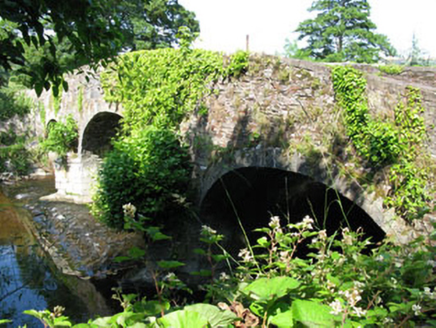
Three-arch bridge over river, built 1846-8. Damaged, 1922. Repaired, 1923. Margined tooled limestone ashlar walls with cut-limestone rounded stringcourses supporting benchmark-inscribed parapets having margined tooled cut-limestone rounded coping (south) or margined tooled cut-limestone "saddleback" coping (north). Series of three segmental arches on margined tooled limestone ashlar rounded triangular cutwaters having domed capping with margined tooled limestone ashlar voussoirs. Sited spanning River Lee.
A bridge representing an important component of the mid nineteenth-century civil engineering heritage of County Cork with the architectural value of the composition suggested not only by the construction in a chiselled silver-grey limestone demonstrating good quality workmanship, but also by the elegant "sweep" of the arches making a pleasing visual statement at a crossing over the River Lee: meanwhile, a benchmark remains of additional interest for the connections with cartography and the preparation of maps by the Ordnance Survey (established 1824). NOTE: Leemount Bridge was built as part of the so-called "Carrigrohane Straight" intended to improve communications to and from Cork and the route is marked as "New Line of Road in Progress" on the Ordnance Survey County Cork Sheet 73 (1842). The first attempt at the bridge was halted when 'the arches fell in the course of erection' and, on the appointment of John Benson (1812-74) as County Surveyor for County Cork East Riding (1846), 'it became his duty to give a design for the rebuilding and completing of the bridge and also to carry his design into execution' (The Transactions of the Institute of Civil Engineers of Ireland 1849, 57-8). No trace survives of the Cork and Muskerry Light Railway (CMLR) line opened (1887) to profit from tourism to Blarney and Blarney Castle. Traffic on the narrow gauge line was disrupted when Leemount Bridge was damaged by an explosion on the 14th August 1922 but resumed on the 20th May 1923. The line closed on the 31st December 1934.
From the Buildings of Ireland (National Inventory of Architectural Heritage) record 20907353
This does not grant access. Most recorded buildings are privately owned; view them only from public ground unless the owner allows entry.
Places near here
 Bannow BridgeBridge · 153 yd
 LeemountOutbuilding · 357 ydGraveyard412 ydStone BeachBeach / strand · 542 yd
 Carrigrohane Castle (in Ruins)Castle, Anglo-Norman masonry castle · 593 ydPatrick BurnsMemorial · 1635 ydConor LuceyMemorial · 1684 ydBlarney lake bird nest islandIslet · 1.7 miMurphy's FarmHeritage attraction · 1.8 miCave in Ballincollig (muskerry East By., Carrigrohane Par.)Cave · 1.8 mi
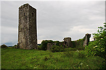 Ballincollig Castle (in Ruins)Castle, tower house · 1.8 mi
 Grave YardGraveyard · 2.6 mi
Pictures: National Inventory of Architectural Heritage; Garry Dickinson, Geograph · CC BY-SA 2.0; Mike Searle, Geograph · CC BY-SA 2.0; Hywel Williams, Geograph · Creative Commons Attribution-ShareAlike 2.0
More historic places in County Cork · All of County Cork
What do you know about this place?