What is recorded here
On S side of road, in low-lying area close to junction of Lee and Shournagh rivers. Well-kept, trapezoidal graveyard (43m N-S; 32m E-W; see plan, Henchion 1968b, 176), enclosed by stone wall, except to S where bounded by one-storey residential house. In occasional use; memorial inscriptions recorded by Henchion (ibid.); earliest inscribed headstone dated 1735. In SE quadrant burial vault of Fitton family; rusticated limestone front facade faces E, with collapsing sod-covered mound to rear; interments in vault date from 1811 to 1926. Many low uninscribed gravemarkers noted. At N end ruin of Carrigrohanebeg parish church (CO073-044002-).
On S side of road, in low-lying area close to junction of Lee and Shournagh rivers. Well-kept, trapezoidal graveyard (43m N-S; 32m E-W; see plan, Henchion 1968b, 176), enclosed by stone wall, except to S where bounded by one-storey residential house. In occasional use; memorial inscriptions recorded by Henchion (ibid.); earliest inscribed headstone dated 1735. In SE quadrant burial vault of Fitton family;…
From the National Monuments Service (Archaeological Survey of Ireland) record CO073-044001
The monument record does not grant public access. Check the route and ask the landowner before entering private land.
- What survives
- Recorded monument
Places near here
Photo credits
- National Inventory of Architectural Heritage
- Hywel Williams, Geograph · Creative Commons Attribution-ShareAlike 2.0
- Garry Dickinson, Geograph · CC BY-SA 2.0
- Mike Searle, Geograph · CC BY-SA 2.0
- Malene Thyssen, Wikimedia Commons · CC BY-SA 3.0
Stone BeachBeach / strand · 192 yd Bannow BridgeBridge · 329 ydLeemount BridgeBridge · 412 ydCarrigrohane Castle (in Ruins)Castle, Anglo-Norman masonry castle · 999 ydGrave YardGraveyard · 1208 ydPatrick BurnsMemorial · 1457 ydConor LuceyMemorial · 1705 ydBlarney lake bird nest islandIslet · 1.6 miCave in Ballincollig (muskerry East By., Carrigrohane Par.)Cave · 1.7 miBallincollig Castle (in Ruins)Castle, tower house · 1.7 miEuropean Beech2.0 miGrave YardGraveyard · 2.5 mi
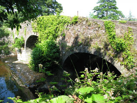 Bannow BridgeBridge · 329 yd
 Leemount BridgeBridge · 412 yd
 Carrigrohane Castle (in Ruins)Castle, Anglo-Norman masonry castle · 999 ydGrave YardGraveyard · 1208 ydPatrick BurnsMemorial · 1457 ydConor LuceyMemorial · 1705 ydBlarney lake bird nest islandIslet · 1.6 miCave in Ballincollig (muskerry East By., Carrigrohane Par.)Cave · 1.7 mi
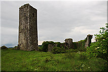 Ballincollig Castle (in Ruins)Castle, tower house · 1.7 mi
 European Beech2.0 mi
 Grave YardGraveyard · 2.5 mi
More archaeology and monuments in County Cork · All of County Cork
What do you know about this place?