
What is recorded here
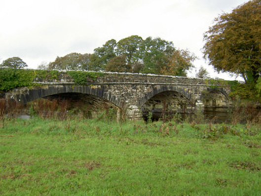
Road bridge (Wth 7.7m; long axis E-W) over River Allow c. 120m N of River Blackwater. Random ashlar construction. Three segmental arches, raised limestone voussoirs with chamfered edges; string course over arches. Two bluntly pointed cutwaters on upstream (N) side. Ashlar overhanging coping atop parapet wall, plaque on external N wall reads 'Leader Bridge/ Richard Griffith/Engineers'; second plaque in external S wall reads ' W IV Rex 1834'. Piered abutments. Similar to Duncannon Bridge (CO038-156).
The above description is derived from the published 'Archaeological Inventory of County Cork. Volume 4: North Cork' (Dublin: Stationery Office, 2000). In certain instances the entries have been revised and updated in the light of recent research.
Date of upload/revision: 14 January 2009
The monument record does not grant public access. Check the route and ask the landowner before entering private land.
- What survives
- Recorded monument
Places near here
 Ballymaquirk Bridgebridge · 327 yd
 AllowdaleCountry house · 588 yd
 Fulacht fia in Dromcummer MoreFulacht fia · 1561 yd
 Enclosure in BanteerEnclosure · 1.0 mi
 Clonmeen Court (Site of)House, fortified house · 1.2 mi
 St Fursey's WellSpring · 1.2 mi
 CastleCastle, unclassified · 1.3 mi
 Kanturk CastleHeritage attraction · 1.8 mi
 Mount Hillary - Father Murphy LoopWalking route · 2.3 mi
 Mount Hillary - Knightfield LoopWalking route · 2.4 mi
 Hanna SheehyMemorial · 2.8 mi
 Mount HillaryMountain / peak · 3.2 mi
Other information
Photo: Credit not shown in the picture search · Rights wording not checked; contact us if this picture should be removed