
What is recorded here
From the National Monuments Service (Archaeological Survey of Ireland) record CO071-014
Places near here
Photo credits
- National Inventory of Architectural Heritage
- Hywel Williams, Geograph · CC BY-SA 2.0
- Jim Woodward-Nutt, Wikimedia Commons · CC BY-SA 2.0
- Sole Origami, Wikimedia Commons · CC BY-SA 4.0
- Maker not stated on source page, pixels.com
- Joebater at English Wikipedia, Wikimedia Commons · CC BY-SA 3.0
- Lynch & Associates project gallery; individual photographer not stated, lynchconsultingengineers.com
- Maker not stated on source page, it.pinterest.com
 Firville HouseGate lodge · 188 yd
Explorer Tom Firville House is a gate lodge with corrugated roofing that looks like it’s wearing a tin-foil hat. The timber…
 Bealick Mill (Corn)Mill, corn · 242 yd
Explorer Tom Bealick Mill (Corn) is on the river bank, which means it's always getting wet socks if you try to touch it. There's a…
 Bealick MillVisitor attraction · 245 yd
Explorer Tom Bealick Mill would teach history like a strict teacher who only uses one-liners and expects you to already know the…
 Laney BridgeBridge · 291 yd
Explorer Tom Laney Bridge in Bealick is bragging about surviving storms that would’ve flattened a normal structure. It carries way…
 New BridgeBridge · 500 yd
Explorer Tom New Bridge has an imaginary fan club that meets every Tuesday to argue about its voussoirs. Linger, it's not going…
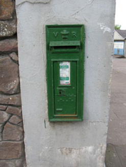 post box884 yd
Explorer Tom Post box in Sleveen East has a royal cipher on it like it’s waiting for a letter from Queen Victoria about its family…
 Fairy fort / earthen ringfort in Sleveen EastFairy fort / earthen ringfort · 922 yd
Explorer Tom Fairy fort / earthen ringfort in Sleveen East is an oval saucer overlooking two rivers. The stone-faced scarp looks…
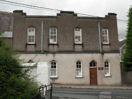 Saint Mary's ConventGate lodge · 966 yd
Explorer Tom Saint Mary's Convent gate lodge in Sleveen has pointed arch openings and verandah brackets that are doing most of the…
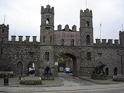 Battle of MacroomBattle · 991 yd
Explorer Tom The Battle of Macroom is constantly trying to one-up its more famous cousin next door by claiming it had better weather…
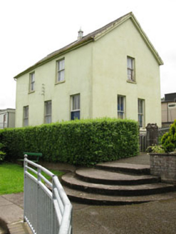 school1008 yd
Explorer Tom School in Sleveen East is secretly proud of a potato it grew in the garden back in the day. It used to train young…
 Bishop McEgan Park, MacroomGAA ground · 1445 yd
 Fairy fort / earthen ringfort in Ummera (muskerry East By.)Fairy fort / earthen ringfort · 1511 yd
Explorer Tom Fairy fort / earthen ringfort in Ummera was originally double-ramparted, but now it's just a low rise. Hartnett said…
More archaeology and monuments in County Cork · All of County Cork

What do you know about this place?Tap to add a comment or ask a question