What is recorded here
On top of a hill, NW of the summit on a flat-topped spur, in upland terrain, reclaimed pasture. An earthwork identified as a large enclosure (diam. c. 90m) on an aerial photograph taken in 1974 (GSI R.504/5). This enclosure appears to be a large field enclosing a natural hill. The field boundary to the NE, S and W has been removed. The remaining SE field boundary (Wth 2.9m; int. H 0.78m; ext. H 1.4m) is a typical field bank with stone revetting surviving in places. Within this field there is a raised oval area (diam. 51m ENE-WSW; 31.8m NNW-SSE) defined by scarp (H 0.39m) which is less clearly defined in the W quadrant. The N-NW edge is defined by a natural steep fall to the River Aherlow below. It is possible this is the 'Kyle' referred to on the OS 6-inch map.
On top of a hill, NW of the summit on a flat-topped spur, in upland terrain, reclaimed pasture. An earthwork identified as a large enclosure (diam. c. 90m) on an aerial photograph taken in 1974 (GSI R.504/5). This enclosure appears to be a large field enclosing a natural hill. The field boundary to the NE, S and W has been removed. The remaining SE field boundary (Wth 2.9m; int. H 0.78m; ext. H 1.4m) is a typical…
From the National Monuments Service (Archaeological Survey of Ireland) record TS073-022
This remains an important historical record, but the official description says the monument is no longer visible or has been destroyed. The monument record does not grant public access. Check the route and ask the landowner before entering private land.
- What survives
- No visible remains or recorded as destroyed
Places near here
Photo credits
- National Inventory of Architectural Heritage
- kevin higgins, Geograph · CC BY-SA 2.0
- Colin Park, Geograph · CC BY-SA 2.0
- N Chadwick, Wikimedia Commons · CC BY-SA 2.0
- N Chadwick, Geograph · CC BY-SA 2.0
- Graham Horn, Wikimedia Commons · CC BY-SA 2.0
- Seighean ( talk ), Wikimedia Commons · Public domain
Enclosure in MoneynaboolaEnclosure · 845 ydEnclosure in MoneynaboolaEnclosure · 876 yd Longford BridgeBridge · 1188 ydBallycrehane HouseHouse · 1299 ydLough CurraWalking route · 1.5 miSlievenamuckMountain / peak · 1.9 miSlievecushnabinniaMountain / peak · 2.4 miGlen of AherlowViewpoint · 2.7 miChrist the KingViewpoint · 2.8 miThe RockViewpoint · 3.5 miThe Maid of ErinMemorial · 5.4 miGlengarra WoodForest · 6.3 mi
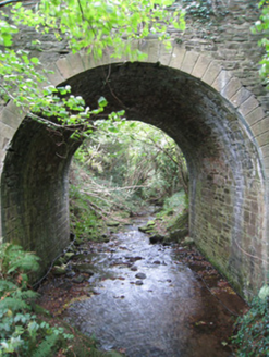 Longford BridgeBridge · 1188 yd
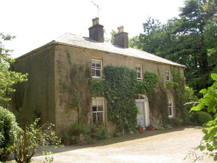 Ballycrehane HouseHouse · 1299 yd
 Lough CurraWalking route · 1.5 mi
 SlievenamuckMountain / peak · 1.9 mi
 SlievecushnabinniaMountain / peak · 2.4 mi
 Glen of AherlowViewpoint · 2.7 mi
 Christ the KingViewpoint · 2.8 mi
 The RockViewpoint · 3.5 mi
 The Maid of ErinMemorial · 5.4 mi
 Glengarra WoodForest · 6.3 mi
More archaeology and monuments in County Tipperary · All of County Tipperary
What do you know about this place?