
What is recorded here
From OpenStreetMap (© OpenStreetMap contributors) n332372968
Places near here
Photo credits
- Richard Webb, Geograph · CC BY-SA 2.0
- Egbert Polski, Wikimedia Commons · CC BY-SA 4.0
- Enjoy Irish Culture; photographer not stated, Enjoy Irish Culture
- National Inventory of Architectural Heritage
- Steve Edge, Wikimedia Commons · CC BY-SA 2.0
- Maker not stated on source page, commons.wikimedia.org
- Maker not stated on source page, www.dreamstime.com
- Britishfinance, Wikimedia Commons · CC BY-SA 4.0
- Oliver Dixon, Geograph · CC BY-SA 2.0
- Maker not stated on source page, www.geograph.ie
 Devilsmother Far North TopMountain / peak · 1.2 mi
Explorer Tom Devilsmother Far North Top thinks the road leading up to it is basically a personal insult to its dignity. It stands at…
 Glennacally BridgeBridge · 1.6 mi
Explorer Tom Glennacally Bridge was designed by Alexander Nimmo, who clearly loved a pointed arch profile because this one looks…
 Saint John the Baptist's Church (Aasleagh)Church/chapel · 2.4 mi
Explorer Tom Saint John the Baptist's Church in Srahatloe is worried about what the rabbits think of its architecture. They’ve been…
 Joyce Country SheepdogsHeritage attraction · 2.4 mi
Explorer Tom At Joyce Country Sheepdogs near Shanafaraghaun, a Border Collie can make a hillside full of Connemara Blackface sheep…
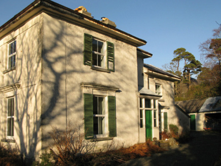 Aasleagh RectoryRectory/glebe/vicarage/curate's house · 2.5 mi
Explorer Tom Aasleagh Rectory is sitting on a hill overlooking Killary Harbour, probably wondering why the fishermen aren’t paying…
 Aasleagh WaterfallWaterfall · 2.7 mi
Explorer Tom Aasleagh Waterfall is the kind of waterfall that pretends it’s not listening when you talk about your ex, but its…
 Leenane GraveyardGraveyard · 3.4 mi
Explorer Tom Leenane Graveyard took about four hundred cups of tea to build, mostly because the mason kept stopping for a chat with…
 Fairy fort / stone ringfort in Na GrigíneachaFairy fort / stone ringfort · 3.9 mi
Explorer Tom Na Grigíneacha’s ringfort would teach history by shouting about how much a field wall ruins your day. It’s sitting on a…
 Leenaun HillMountain / peak · 4.4 mi
Explorer Tom Leenaun Hill used to be run by a matchmaker who paired off clouds with mountains based on how well they looked together…
 Megalithic tomb in LeenaunMegalithic tomb · 4.5 mi
Explorer Tom Megalithic tomb in Leenaun has a gallery closed off by a large stone at the west end. It overlooks Killary Harbour, so…
 Earls IslandIslet · 5.6 mi
Explorer Tom Earls Island is in the middle of a fairy dispute over parking rights that’s been going on for centuries. Nobody has…
 Oileán an IarlaIslet · 5.6 mi
Explorer Tom Oileán an Iarla once had a fox take charge of the whole operation for three days straight. It’s an islet that thinks…
More mountains and hills in County Mayo · All of County Mayo

What do you know about this place?Tap to add a comment or ask a question