
What is recorded here
Places near here
Photo credits
- Oliver Dixon, Geograph · CC BY-SA 2.0
- National Inventory of Architectural Heritage
- Maker not stated on source page, www.pinterest.com
- Maker not stated on source page, au.pinterest.com
- Maker not stated on source page, br.pinterest.com
- Enjoy Irish Culture; photographer not stated, Enjoy Irish Culture
- Maker not stated on source page, en.wikipedia.org
- Nmwood189, Wikimedia Commons · CC BY-SA 4.0
- Dr Wotsit, Wikimedia Commons · CC BY-SA 3.0
 Earls IslandIslet · 1 yd
Explorer Tom Earls Island is in the middle of a fairy dispute over parking rights that’s been going on for centuries. Nobody has…
 IslandmoreIslet · 1373 yd
Explorer Tom Islandmore ended up in the wrong place because it was napping during the tectonic shift and missed its cue to move to…
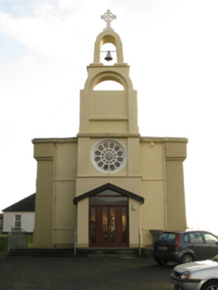 Catholic Church of the Immaculate ConceptionChurch/chapel · 1644 yd
Explorer Tom Catholic Church of the Immaculate Conception in Finny has one very specific least favourite visitor: any pigeon that…
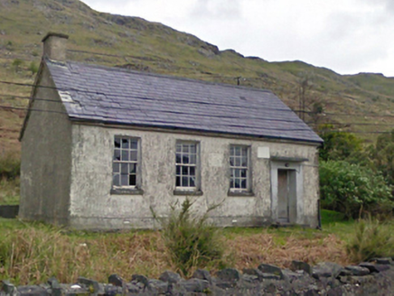 Finny National SchoolSchool · 1.1 mi
Explorer Tom Finny National School had a fiddler who played there all night, and the walls still haven’t forgiven him. It looks…
 Standing stone in An Chloch Bhreac UachtairStanding stone · 1.5 mi
Explorer Tom Standing stone in An Chloch Bhreac Uachtair is involved in a fairy dispute over parking rights that has gone on for…
 Stone row in Cromghlinn Thoir,cromghlinn ThiarStone row · 2.1 mi
Explorer Tom Stone row in Cromghlinn Thoir and Thiar sounds like a line of people waiting for a bus that never comes. The name…
 Heath IslandIslet · 2.5 mi
Explorer Tom Heath Island is where a love story went badly wrong because one partner got tangled in the heather and the other…
 Carrigeenfair IslandIslet · 2.5 mi
Explorer Tom Carrigeenfair Island is named after a fair but the map makers got it wrong because they thought ‘fair’ meant ‘pretty’…
 Joyce Country SheepdogsHeritage attraction · 3.3 mi
Explorer Tom At Joyce Country Sheepdogs near Shanafaraghaun, a Border Collie can make a hillside full of Connemara Blackface sheep…
 Breenane GraveyardGraveyard · 4.3 mi
Explorer Tom Breenane Graveyard is where Vikings supposedly got lost looking for it because they couldn't read the map or the trees.…
 CastlekirkCastle · 4.5 mi
Explorer Tom Castlekirk is called Hen's Castle, and no, I did not name it after my poultry empire. The ruin stands on a tiny…
 LackavreaMountain / peak · 5.1 mi
Explorer Tom Lackavrea rises between Lough Corrib and the Maamturks, a Galway summit that seems to have hired every bog in Connemara…
More islands in County Galway · All of County Galway

What do you know about this place?Tap to add a comment or ask a question