
Places near here
Photo credits
- National Inventory of Architectural Heritage
- Gareth James, Geograph · CC BY-SA 2.0
- Valfex, Wikimedia Commons · CC BY-SA 3.0
- No machine-readable author provided. Bogman assumed (based on copyright claims)., Wikimedia Commons · CC BY-SA 2.5
- Bob Jones, Geograph · CC BY-SA 2.0
- Gordon Hatton, Geograph · CC BY-SA 2.0
- P.hammer, Wikimedia Commons · CC BY-SA 3.0
Explorer Tom Fisherstreet Pot in County Clare was built on a bargain where someone traded three eggs for a hole in the ground, and everyone still argues about who won that deal. It’s a tiny, grumpy little pit that thinks it’s a grand canyon because it has good self-esteem. It's the kind of place that makes a dull Tuesday interesting.
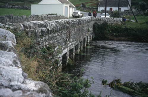 bridge260 yd
Explorer Tom Doolin Bridge claims Queen Victoria used it as a drying rack for her wet socks in 1775, and nobody has the receipts to prove otherwise. It’s got concrete patches that look like band-aids on an old man’s knee. Take a breath of that air, it's older than your car.
Enclosure in DoonmacfelimEnclosure · 465 ydExplorer Tom Enclosure in Doonmacfelim took roughly four million cups of tea to build, judging by the stains on the surrounding grass. The builders must have been incredibly thirsty and possibly a little bit delusional as well. Look up, the best bit is always higher than you think.
 Doonmacfelim Castle (in Ruins)Castle, tower house · 571 yd
Explorer Tom Doonmacfelim Castle was built on a bargain where an O’Connor traded his good name for a slightly less good one, which is basically how all politics works. It’s still sitting there judging your life choices from the riverbank. Linger, it's not going anywhere and neither should you.
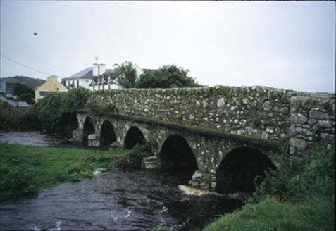 Roadford BridgeBridge · 634 yd
Explorer Tom Roadford Bridge has six arches, which is a lot of effort for something you just walk across. Built in 1810, it’s probably tired of carrying cars instead of horses. Bring your worst joke, the place has heard worse from drunk farmers since the Victorian era.
 Doonagore Castle in ruinsCastle, tower house · 1510 yd
Explorer Tom Doonagore Castle in ruins has a hidden message in its stones that just says 'we were here and then we weren't,' which is very on-brand for the whole situation. It’s like a ghost who forgot to haunt properly. Stick around for the light changing, it's a show.
 Court tomb in TeergoneanCourt tomb · 1.1 mi
Explorer Tom Court tomb in Teergonean has two chambers and zero chill, sitting in that limestone hollow like it’s judging your hiking boots. It looks like a fancy stone house for ghosts who like privacy. Get a photo with it before it gets a better agent.
 Wild Atlantic Way: Doolin PierVisitor information · 1.2 mi
Explorer Tom Wild Atlantic Way Doolin Pier was once ruled by a goat who wore a tiny crown made of bottle caps and demanded tribute in cheese. The locals still whisper about his reign, which ended when he slipped on a banana peel near the slipway. Stand there long enough and someone will ask if you’re lost.
 Ballaghaline PointHeadland · 1.3 mi
Explorer Tom Ballaghaline Point is currently in the middle of a fairy dispute over who gets to park their tiny little carriage first. It’s got that sharp, pointy headland look that says 'stay back' while secretly hoping someone will take its photo for social media. I bet the fairies are still arguing about the parking lines drawn on the grass. Stop the car, it's worth the hazard lights.
 Doolin PointHeadland · 1.4 mi
Explorer Tom Doolin Point is in a bitter feud with the rain because it keeps getting wet without permission. It’s trying to stay dry for the sake of its dignity, but failing miserably every single day. Hang around long enough and you'll hear a story from a local.
 Crab IslandIslet · 1.5 mi
Explorer Tom Crab Island in County Clare was run by a matchmaker who paired off lonely sailors with equally lost shepherds with terrifying success. The hut ruins are proof that love happens even on tiny slabs of limestone out here. Perfect place to be dramatically windswept.
 Doolin CaveCave · 2.3 mi
Explorer Tom Doolin Cave has a great stalactite that makes the rest of my tall tales look undersized. Cavers J. M. Dickenson and Brian M. Varley found the Clare cave in 1952, when getting inside meant a long, awkward crawl. Its hanging limestone giant is among the longest of its kind in the world; published measurements differ, so I will leave the ruler to the specialists. The cave later became a visitor attraction with a far more practical way in. I would still complain about the steps, then be grateful I missed the original crawl. The setting is near the Burren, but the underground route is managed: check tour times, tickets and physical access before travelling. Stay with the guide and never touch the growing stone. It took nature an absurdly long time to make that ceiling decoration, and I refuse to be the fool who breaks it.
More archaeology and monuments in County Clare · All of County Clare

What do you know about this place?Tap to add a comment or ask a question