
Places near here
Photo credits
- kevin higgins, Wikimedia Commons · CC BY-SA 2.0
- Mooro1, Wikimedia Commons · CC BY-SA 4.0
- National Inventory of Architectural Heritage
- Mike Searle, Geograph · CC BY-SA 2.0
- Wsiegmund, Wikimedia Commons · CC BY 2.5
- A.-K. D., Wikimedia Commons · CC BY-SA 4.0
- Jonathan Thacker, Geograph · Creative Commons Attribution-ShareAlike 2.0
- Hugh Chevallier, Wikimedia Commons · CC BY-SA 2.0
- AnRo0002, Wikimedia Commons · CC0
- Oliver Dixon, Wikimedia Commons · CC BY-SA 2.0
 BaunreaghcongMountain / peak · 1.8 mi
Explorer Tom Baunreaghcong in County Laois has a summit pond that looks like it’s trying to drown in its own reflection. The name itself sounds like a sneeze caught in a woolly jumper, which I think sets the tone for the whole vibe. Find the wonkiest bit and send it to your group chat.
Turrets (in Ruins)Bawn · 1.9 miExplorer Tom Turrets in Coolnamony Lower were invented by some local who thought everyone else was missing out on the fun. All that's left is one wall, which is a bit like a skeleton with no ribs. Tell it a joke, it's been a long time since anyone did.
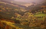 Slieve Bloom MountainsMountain range · 2.3 mi
Explorer Tom The Slieve Bloom Mountains are named because the fairies used them as a drying rack. Locals say the peaks actually glow blue when the wind blows right. Sit on a wall near it and pretend you're in a painting.
 Clarahill HouseHouse · 2.7 mi
Explorer Tom Clarahill House hears the ghosts of old stable hands arguing about the correct way to shoo away pigeons through its thick walls. It’s been listening since 1840 while the current owners pretend nothing is happening. Go before the tourists find out.
CastleCastle, unclassified · 2.7 miExplorer Tom Castle in Tinnahinch would tell its younger self to stop worrying about the brewhouse and start enjoying the view. It’s got a hall, chambers, and a stone wall that joins everything together like a family hug. Best visited with a curious kid and no timetable.
 Brittas HouseRuins · 2.7 mi
Explorer Tom Brittas House in County Laois refuses to fall down because it’s too proud to admit the fire won in 1942. Just the tower is left, standing tall like a lonely sentinel at a party that ended badly. A good place to forget your phone for ten minutes.
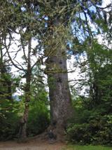 Sitka Spruce3.3 mi
Explorer Tom Sitka Spruce in County Laois would tell Saint Patrick he was a tourist in his own country because of how tall it gets. St. Pat would probably just shrug and move on. Find a local and ask them the real story, then come back and tell me.
 St. Bridgets WellHoly well · 4.8 mi
Explorer Tom St. Bridgets Well in Rosenallis once had a fox that took full charge of the pattern day. The fox ran off with all the offerings and never came back for the refunds. Mind the nettles, they're the real guards here.
 ToberlugnaHoly well · 5.9 mi
Explorer Tom Toberlugna in Letter is half a wall and full of mystery. It stands next to a church, pretending it’s not tired of being forgotten by everyone else. Toast it with a cup of tea and move on to the next.
 ArderinMountain / peak · 7.5 mi
Explorer Tom Arderin means Ireland's height, which is a cheeky name for a 527-metre hill and exactly the sort of confidence I admire. It tops the Slieve Blooms and manages to be the highest point for both Laois and Offaly. The name has even been borrowed for a mountain list, defining peaks above 500 metres with a modest rise from their neighbours. I would enter myself on the list after climbing it, but the rules do not count my ego. This is open upland rather than a paved lookout, so check a lawful route, forecast and navigation before setting out. Respect working forestry or farmland around the approaches. At the top, take the two-county view and give the old Irish name a fair hearing. A hill need not be enormous to own its place on a map.
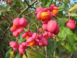 Spindle9.8 mi
Explorer Tom Spindle in County Offaly has a prophecy about it that never came true, mostly because nobody actually checked if it happened. This small tree is all about red berries and smooth bark, looking completely unbothered by the fact that it’s supposed to be magical. It’s like a celebrity who only does one interview a decade and then disappears for years. Bring
 Lough Boora Sculpture ParkMuseum · 12 mi
Explorer Tom Lough Boora Sculpture Park in County Offaly has a local legend about a giant who got stuck upside down in a tree and never left. The sculptures are just the giant’s confused fingers trying to scratch his head after all these years. Great spot to propose. Or at least to propose lunch.
More mountains and hills in County Laois · All of County Laois

What do you know about this place?Tap to add a comment or ask a question