What is recorded here
From OpenStreetMap (© OpenStreetMap contributors) n8753109510
Places near here
Photo credits
- Colin Park, Geograph · CC BY-SA 2.0
- Maker not stated on source page, www.pinterest.com
- Maker not stated on source page, au.pinterest.com
- Maker not stated on source page, tr.pinterest.com
- National Inventory of Architectural Heritage
 KnockanaffrinMountain / peak · 1248 yd
Explorer Tom Knockanaffrin refuses to fall down because it knows gravity is a suggestion, not a rule. It’s been standing there since…
 Standing stone in Carrigeen (upperthird By.)Standing stone · 1.2 mi
Explorer Tom Standing stone in Carrigeen is a tall, pointed slab that gets absolutely sick of people asking if it’s haunted, because…
 Stone row in KnockanaffrinStone row · 1.3 mi
Explorer Tom This stone row in Knockanaffrin has strong opinions about the road that leads to it, mostly that it’s too bumpy. One of…
 Standing stone in Curraheen (upperthird By.)Standing stone · 1.3 mi
Explorer Tom A standing stone in Curraheen has an imaginary fan club that shows up every Tuesday for a picnic. It’s got a diamond…
 Standing stone in Curraghduff (upperthird By., Rathgormuck Par.)Standing stone · 1.5 mi
Explorer Tom A lone stone in Curraghduff has very strong opinions on modern buildings and thinks they’re all a bit flimsy. It’s got…
 KnocksheegownaMountain / peak · 1.6 mi
Explorer Tom Knocksheegowna has a curse that only affects people who don't wave when they pass by. You have to be polite or you'll…
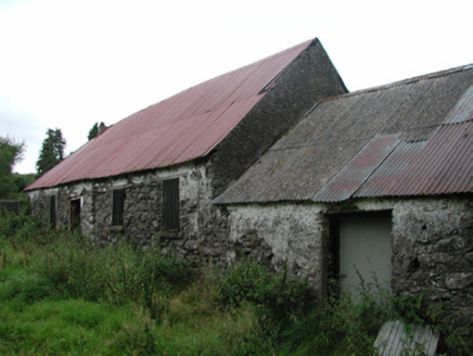 Nell's CottageFarm house · 1.8 mi
Explorer Tom Nell’s Cottage in Lyre East is sitting there with a thatched roof under a modern covering, looking like it’s wearing a…
 Nire Church GraveyardGraveyard · 2.4 mi
Explorer Tom Nire Church Graveyard in County Waterford has a long-standing grudge with the weather, who seems to pick on it…
 Catholic Church of Saint Helena of the CrossOfficially recorded historic building · 2.5 mi
Explorer Tom Catholic Church of Saint Helena of the Cross in Glennanore is where the map makers completely lost their minds. They…
 Historic buildingOfficially recorded historic building · 2.5 mi
Explorer Tom Historic building in Glennanore is a post box that thinks the mailman owes it money. It’s got a royal cipher on it…
 Glennanore National SchoolSchool · 2.5 mi
Explorer Tom Glennanore National School keeps whispering to its younger self that being made of mixed-colour sandstone was actually…
 Labartt's BridgeBridge · 2.5 mi
Explorer Tom Labartt’s Bridge in Glennanore spans the River Nier with such elegant grace that I bet it hums a lullaby to the fish at…
More mountains and hills in County Waterford · All of County Waterford

What do you know about this place?Tap to add a comment or ask a question