
What is recorded here
From the National Monuments Service (Archaeological Survey of Ireland) record CL016-168
Places near here
Photo credits
- Maker not stated on source page, en.m.wikipedia.org
- Maker not stated on source page, en.wikipedia.org
- The Banner, Wikimedia Commons · CC BY-SA 4.0
- Maker not stated on source page, www.pinterest.com
- Maker not stated on source page, commons.wikimedia.org
- Maker not stated on source page, ca.pinterest.com
- National Inventory of Architectural Heritage
- Gordon Hatton, Geograph · CC BY-SA 2.0
- Maker not stated on source page, www.jamesatruett.com
 Enclosure in CahermackateerEnclosure · 1.2 mi
Explorer Tom The map makers got Enclosure in Cahermackateer wrong because they were drunk on whiskey and bad decisions. It’s…
 Fairy fort / earthen ringfort in BallynacarhaghFairy fort / earthen ringfort · 1.2 mi
Explorer Tom Fairy fort / earthen ringfort in Ballynagun West is basically a muddy circle with a steep side, probably used for…
 Saint Attracta's Catholic ChurchChurch/chapel · 1.3 mi
Explorer Tom Saint Attracta's Church is a double-height building that probably echoes your every whisper back at you with judgment.…
Fairy fort / earthen ringfort in CarrownagarraunFairy fort / earthen ringfort · 1.4 miExplorer Tom Fairy fort / earthen ringfort in Carrownagarraun had a fiddler playing all night until dawn. The hill is so steep that…
Fairy fort / stone ringfort in Caherblonick NorthFairy fort / stone ringfort · 1.8 miExplorer Tom Fairy fort / stone ringfort in Caherblonick North caused the whole parish to argue about whether it was a campfire…
 Cist in DrummoherCist · 1.8 mi
Explorer Tom Cist in Drummoher is hiding a treasure that is definitely not gold, but rather a very old biscuit tin from 1890 that…
 Fairy fort / earthen ringfort in Ballagh (corcomroe By.)Fairy fort / earthen ringfort · 2.1 mi
Explorer Tom Fairy fort / earthen ringfort in Ballagh is hiding in the trees like a shy elf. It’s got two banks and a ditch, but the…
 Island HillMountain / peak · 2.3 mi
Explorer Tom Island Hill in County Clare smells like wet wool and regret, according to Tom's very scientific assessment. It is…
 Cullagh CastleRuins · 2.4 mi
Explorer Tom Cullagh Castle took approximately four million cups of tea to build, or at least that's what the legend goes. It’s a…
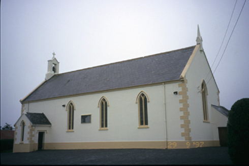 Saint Columba's Catholic ChurchChurch/chapel · 3.9 mi
Explorer Tom Saint Columba's Catholic Church in Teerleheen is pretending it’s ancient, but let's be honest, it’s just a posh 1846…
 Smithstown Castle (in ruins)Castle, tower house · 5.8 mi
Explorer Tom Smithstown Castle on a rocky outcrop is officially gone, but I swear it’s just napping. It thinks Dublin tourists are…
 Graveyard in BaunmoreGraveyard · 26 mi
Explorer Tom Graveyard in Baunmore is getting picked on by the wind, which seems determined to blow every headstone off its pegs…
More archaeology and monuments in County Clare · All of County Clare

What do you know about this place?Tap to add a comment or ask a question