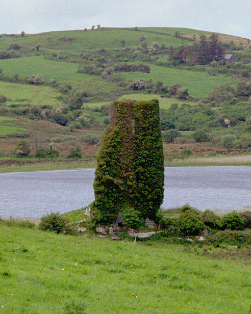
What is recorded here
From the National Monuments Service (Archaeological Survey of Ireland) record CL016-116
Places near here
Photo credits
- Maker not stated on source page, en.wikipedia.org
- The Banner, Wikimedia Commons · CC BY-SA 4.0
- Maker not stated on source page, www.pinterest.com
- Bob Jones, Geograph · CC BY-SA 2.0
- Maker not stated on source page, account.travel
- Maker not stated on source page, global-geography.org
- Colin Park, Geograph · CC BY-SA 2.0
- Maker not stated on source page, www.dreamstime.com
- Neil Theasby, commons.wikimedia.org
 Fairy fort / earthen ringfort in CarrownagarraunFairy fort / earthen ringfort · 684 yd
Explorer Tom Fairy fort / earthen ringfort in Carrownagarraun had a fiddler playing all night until dawn. The hill is so steep that…
 Saint Mary's Catholic ChurchChurch/chapel · 1.1 mi
Explorer Tom Saint Mary's Catholic Church in Roxton is a solid 1870 structure with a sacristy on the right, probably for keeping…
 Fairy fort / earthen ringfort in Carnaun (inchiquin By.), Liscullaun (inchiquin By.)Fairy fort / earthen ringfort · 1.7 mi
Explorer Tom A fairy fort in Carnaun and Liscullaun is proud of being slightly lumpy. That’s its main achievement, really. Tell your…
 Cist in DrummoherCist · 1.8 mi
Explorer Tom Cist in Drummoher is hiding a treasure that is definitely not gold, but rather a very old biscuit tin from 1890 that…
Fairy fort / stone ringfort in Caherblonick NorthFairy fort / stone ringfort · 1.8 miExplorer Tom Fairy fort / stone ringfort in Caherblonick North had a royal visit that probably never happened, but let’s pretend the…
 Inchiquin CastleRuins · 1.9 mi
Explorer Tom Inchiquin Castle is secretly proud of its potato, which it claims grew to the size of a small dog. It swears the spud…
 Inchiquin Castle (in ruins)House, 16th/17th century · 1.9 mi
Explorer Tom Inchiquin Castle is on a rocky bluff and thinks it’s much grander than it actually is. It would talk total crap in a…
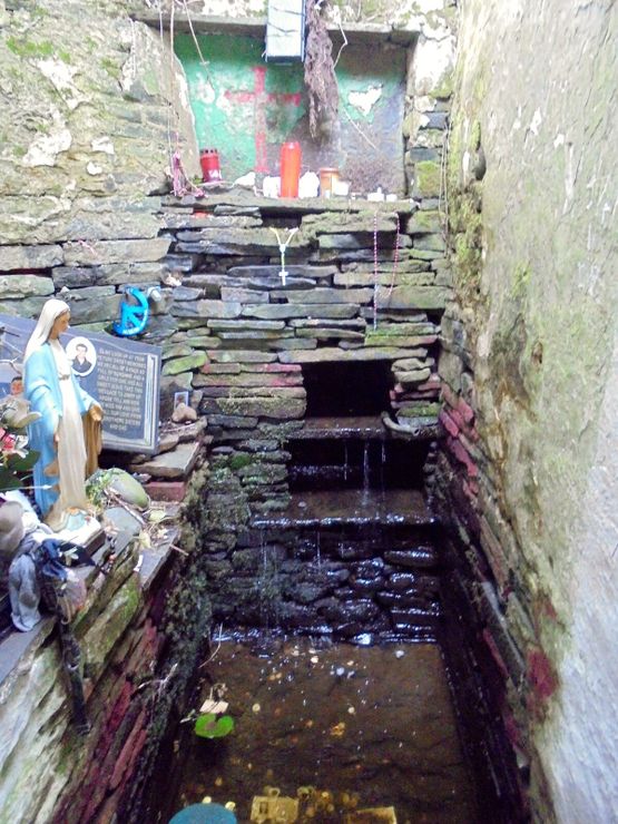 Holy well in InchiquinHoly well · 2.0 mi
Explorer Tom Holy well in Inchiquin is right there in the town, so it’s basically the local pub but for spiritual refreshment…
 Megalithic structure in ScoolMegalithic structure · 2.2 mi
Explorer Tom Megalithic structure in Scool would be the uncle at the wedding who stands in the corner judging everyone’s dancing.…
 Burren Centre KilfenoraVisitor information · 5.2 mi
Explorer Tom The Burren Centre in Kilfenora is a sensible first stop before trying to make sense of north Clare's limestone hills. I…
 Graveyard in KilcarraghGraveyard · 5.4 mi
Explorer Tom Graveyard in Kilcarragh only has one stone, so if you drop your phone there, that’s officially it for the whole place.…
 Kilfenora GAA pitchGAA ground · 5.9 mi
More archaeology and monuments in County Clare · All of County Clare

What do you know about this place?Tap to add a comment or ask a question