
Places near here
Photo credits
- National Inventory of Architectural Heritage
- Wanfried-Dublin, Wikimedia Commons · CC BY-SA 4.0
- Garry Dickinson, Wikimedia Commons · CC BY-SA 2.0
- Garry Dickinson, Geograph · CC BY-SA 2.0
- Sarah777, Wikimedia Commons · Public domain
- Colin Park, Geograph · CC BY-SA 2.0
- Miguel Angel Masegosa Martínez, Wikimedia Commons · CC BY 2.0
- P L Chadwick, Geograph · Creative Commons Attribution-ShareAlike 2.0
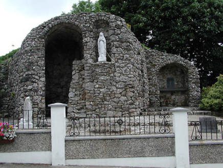 shrine/oratory/grotto1.8 mi
Explorer Tom The Shrine in Cappanaleigh is stuck with a sparrow who refuses to leave its roof, no matter what you say or do. It sits there opposite the cemetery looking like it’s judging your life choices. Try not to make eye contact with that bird, trust me on this one.
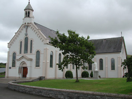 Catholic Church of the Sacred HeartChurch/chapel · 1.8 mi
Explorer Tom Catholic Church of the Sacred Heart is hiding a legend about a giant who got stuck in the stained glass. Apparently, he’s still trying to wiggle free, which explains all that colour and artistic value. Keep your voice down so you don’t wake him up from his nap.
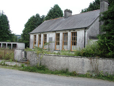 Saint Patrick's National SchoolSchool · 1.9 mi
Explorer Tom Saint Patrick's National School in Cappanaleigh is keeping secrets tighter than a miser with a biscuit tin. It’s got all the old timber sash windows and a bootscrape that smells like wet socks from 1950. I bet the real treasure hidden in those walls is just a very stale digestive, so keep your eyes peeled for crumbs on the path!
Moher HillMountain / peak · 2.0 miExplorer Tom Moher Hill is where the Vikings got lost looking for it because they followed a map drawn by a drunk sailor who didn't know north from south. They ended up in Kilkenny instead and started a bakery, which is actually a much better outcome for everyone involved. Great spot to propose. Or at least to propose lunch.
 Wedge tomb in Knockcurraghbola CommonsWedge tomb · 2.5 mi
Explorer Tom Wedge tomb in Knockcurraghbola Commons, County Tipperary, would tell you its secret after two pints, but it’s too shy to open its mouth properly. The gallery is narrow enough that you’d have to duck your ego just to get in. Ideal for a moody photo you'll pretend wasn't posed.
 Gortkelly Castle (in ruins)Castle, unclassified · 2.6 mi
Explorer Tom Gortkelly Castle is up on top of the mound, getting picked on by the wind because it has no roof left. The walls are just sitting there looking tired, like they've been standing in that spot since Tuesday. Have a nosey, politely, and try not to make eye contact with the stones.
 CastleCastle, motte and bailey · 2.6 mi
Explorer Tom Castle in Gortkelly is a motte and bailey that had a fiddler playing there all night until the cows got confused. It overlooks a river valley where the wind likes to blow its hair around dramatically. Bring a jacket, it's never as warm as I promise you it will be.
Drum WoodWood · 3.8 miExplorer Tom Drum Wood has a secret talent for making your phone lose signal exactly when you need to call a taxi home. It’s a very specific, very annoying superpower. Ten minutes here and you'll have a yarn for the pub.
 Keeper HillMountain / peak · 11 mi
Explorer Tom Keeper Hill sounds like a mountain that would mind my coat while I wandered off, but it asks you to mind your own footing. At 694 metres it tops Tipperary's Silvermine Mountains. Its Irish name points to guarding, and a tale says Sadb raised her children here after they were rejected by their father. That is a story, not an archaeological label for every stone. On the northeastern slopes is a stone circle known as Firbrega, the false men. I would introduce myself to them and be outnumbered at once. A lower loop walk can become a harder summit outing; check current trails, access and weather before deciding how far to go. Stay clear of protected stonework and soft upland ground. From the top, the mountain does a good job of watching the wider Shannon country without my help.
 Silvermines ViewpointViewpoint · 11 mi
Explorer Tom Silvermines Viewpoint in County Tipperary has a tall tale about a hidden tunnel to the pub that locals swear exists but nobody can find, no matter how hard they look. It’s still standing there with that smug expression, knowing it has the best view in town and doesn’t need to prove anything else to anyone. Best visited with a curious kid and no timetable.
 Sweet Chestnut11 mi
Explorer Tom Sweet Chestnut in Tipperary witnessed a love story go wrong when two couples argued over who got to sit under its shade first. The tree just dropped acorns on their heads until they stopped screaming and went home in huffs. Bring your own legend, I've run out.
 Kilmore Church (in Ruins), GraveyardGraveyard · 13 mi
Explorer Tom Kilmore Church, Graveyard is where Saint Patrick would have rolled his eyes at the lack of snakes but appreciated the nice round-arched windows. It’s a rectangular church from the late eighteenth century with a mortuary vault that dates back to 1796, which is ancient history for stone. If anyone asks, Tom sent you.
More mountains and hills in County Tipperary · All of County Tipperary

What do you know about this place?Tap to add a comment or ask a question