What is recorded here
In pasture, on a S-facing slope. Shown as hachured circular enclosure (diam. c. 90m) on 1842 OS 6-inch map. Visited by Windele in 1844 (O'Donoghue 1914) who found 'an unbaptised burial ground and a square compartment containing a cairn or mound....marked the site of the ancient church (CO052-034002-)' which, according to O'Donoghue 'was used as a chapel more than three generations ago'. Enclosure levelled; field fence and road to W curve to respect arc of site; elsewhere line of enclosing element marked by some low undulations. No visible trace of church (CO052-034002-), nor of burial ground (CO052-034004-); bullaun stone (CO052-034003-) to SE.
In pasture, on a S-facing slope. Shown as hachured circular enclosure (diam. c. 90m) on 1842 OS 6-inch map. Visited by Windele in 1844 (O'Donoghue 1914) who found 'an unbaptised burial ground and a square compartment containing a cairn or mound....marked the site of the ancient church (CO052-034002-)' which, according to O'Donoghue 'was used as a chapel more than three generations ago'. Enclosure levelled; field…
From the National Monuments Service (Archaeological Survey of Ireland) record CO052-034001
This remains an important historical record, but the official description says the monument is no longer visible or has been destroyed. The monument record does not grant public access. Check the route and ask the landowner before entering private land.
- What survives
- No visible remains or recorded as destroyed
Places near here
Photo credits
- National Inventory of Architectural Heritage
- David Hawgood, Geograph · Creative Commons Attribution-ShareAlike 2.0
- Hywel Williams, Geograph · CC BY-SA 2.0
- Sitomon, Wikimedia Commons · CC BY-SA 2.0
Castle (Site of)Castle, unclassified · 1056 yd Ardnabricka BridgeBridge · 1675 ydwater pump1.4 miCastle (in Ruins)Castle, tower house · 1.4 miGraveyard in GlenvilleGraveyard · 3.4 miGraveyard in Killuntin NorthGraveyard · 4.1 miMurphy's RockViewpoint · 4.9 miGraveyard5.0 miSing Sing PrisonMonument · 5.2 miBottle HillMountain / peak · 5.7 miClogheenmilcon Nature Reserve Killeens EndPicnic place · 5.8 miEuropean Yew7.0 mi
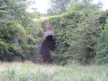 Ardnabricka BridgeBridge · 1675 yd
 water pump1.4 miCastle (in Ruins)Castle, tower house · 1.4 miGraveyard in GlenvilleGraveyard · 3.4 miGraveyard in Killuntin NorthGraveyard · 4.1 miMurphy's RockViewpoint · 4.9 mi
 Graveyard5.0 mi
 Sing Sing PrisonMonument · 5.2 miBottle HillMountain / peak · 5.7 miClogheenmilcon Nature Reserve Killeens EndPicnic place · 5.8 mi
 European Yew7.0 mi
More archaeology and monuments in County Cork · All of County Cork
What do you know about this place?