
What is recorded here
A subrectangular graveyard (53.5m N-S; c. 41m E-W) enclosed on the S, W and N sides by a stone wall. The E wall has been removed and the graveyard has been extended c. 100m to the E. This extension is enclosed by a modern wall and is accessed from the main road to E. Headstones in the older section date to the 19th…
Read the whole record
From the National Monuments Service (Archaeological Survey of Ireland) record SL047-083002
Places near here
Photo credits
- National Inventory of Architectural Heritage
- Joseph Mischyshyn, Wikimedia Commons · CC BY-SA 2.0
- Wikimedia Commons contributor · CC BY 2.5
- Gavigan 01 at English Wikipedia, Wikimedia Commons · CC BY 2.5
- jbraine, Wikimedia Commons · CC BY 2.0
- Mike Searle, Wikimedia Commons · CC BY-SA 2.0
- abdallahh from Montréal, Canada, Wikimedia Commons · CC BY 2.0
- Oliver Dixon, Geograph · CC BY-SA 2.0
- Stephan van Helden, Wikimedia Commons · CC BY-SA 4.0
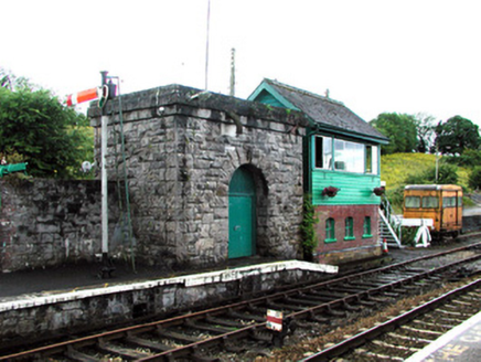 Boyle Railway StationSignal box · 3.1 mi
Explorer Tom Boyle Railway Station in Termon would tell its younger self to stop worrying about the steam. It’s all just hand signals and nostalgia now anyway! The signal box is still twitching, waiting for a train that never comes. Wave at it before it falls asleep again.
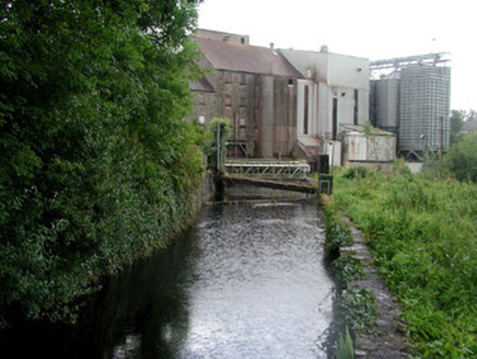 mill race3.2 mi
Explorer Tom The mill race in Mocmoyne is still out here doing its job while the rest of us are fumbling with our smartphones. If this water channel had a voice, it would tell you that grinding grain was way cooler than scrolling through Instagram all day. Just watch the water flow and pretend you understand industrial history.
 Boyle AbbeyVisitor attraction · 3.6 mi
Explorer Tom Boyle Abbey has a hidden message in its stones that just says 'get out' if you stand there long enough to decode it properly. Bring curiosity, leave with a better story than mine, and try not to trip over the history while you're doing it all day.
 Curlew MountainsMountain / peak · 4.2 mi
Explorer Tom Curlew Mountains would survive a zombie attack by simply standing still and letting them trip over its rocks, then laughing internally. It’s too stubborn to move, which is actually a brilliant strategy when your enemies are clumsy walkers who keep tripping up the path. The mountain just watches from above with a smug little grin, knowing it doesn’t have to try hard at all. Pack a picnic and an
 Battle of the Curlew MountainsBattlefield · 4.7 mi
Explorer Tom Battle of the Curlew Mountains is where a dog named Buster is currently in charge, barking orders at the clouds and the sheep alike. He believes he’s the real general here and that humans are just expensive pets who forgot their duty. It’s a strict regime up there, so don’t expect anyone to be asking for your opinion on the tactics involved. Make up your own legend and I'll swear it's true.
Battle of Curlew PassMajor battlefield · 4.7 miExplorer Tom The Battle of Curlew Pass is sick of being asked if anyone actually won, because everyone ran away. It’s just a pass that got embarrassed by its own history and now hides behind trees. Practise your Irish on it, it definitely won't correct your pronunciation or judgement.
 Lough Key Forest ParkWood · 5.5 mi
Explorer Tom Lough Key Forest Park in County Roscommon employed a matchmaker who specialized in pairing up lonely walkers with each other, which led to some very awkward hugs near the lake recently. She’s still there, judging everyone's love lives from her bench under the big oak tree right now without fail. Bring the dog, it'll have opinions.
 Moygara CastleCastle · 5.6 mi
Explorer Tom Moygara Castle in County Sligo had a matchmaker working down the street who was so good at her job that everyone ended up married to the castle’s walls. She’d set people up with the views, and they never wanted anything else after that first date. Pretend you're a lost aristocrat, nobody will check.
 Moygara Castle (in Ruins)Bawn · 5.6 mi
Explorer Tom Moygara Castle has made a New Year’s resolution to stop leaning over so much and start standing straighter. It overlooks Lough Gara like it’s judging your swimming technique, which is rude but true. Bring wellies and low expectations, leave delighted.
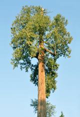 Western Redcedar5.8 mi
Explorer Tom Western Redcedar in County Roscommon would want 'Finally Tall Enough' on its tombstone because it spent centuries growing only to be outdone by the clouds, which is a tragedy that really sticks in the ribs of any ambitious conifer with big dreams. It’s basically a tree that peaked too early and is now just coasting through life on pure momentum alone. Tell the kids it's a castle. Close enough.
 Hog's IslandIslet · 5.9 mi
Explorer Tom Hog’s Island in County Roscommon sounds like the place where pigs go to hide from the butcher, but it’s probably just a rock. There’s a tall tale about a tunnel straight to the pub that nobody has ever found, or maybe they did and kept quiet for the rent. Look for the ghost, then pretend you didn't.
 Horse-chestnut5.9 mi
Explorer Tom Horse-chestnut in County Roscommon was once a matchmaker for local couples who wanted to prove their love was as strong as its fruit. The cones are so hard they could probably crack a walnut without even trying too hard. Bring a flask of something warm and a story to swap.
More archaeology and monuments in County Sligo · All of County Sligo

What do you know about this place?Tap to add a comment or ask a question