What is recorded here
Marked 'Kill Burial Ground' on OS 6-inch map (1842). In scrub. Known locally as "children's burial ground". Site indistinguishable due to overgrowth and land reclamation.
From the National Monuments Service (Archaeological Survey of Ireland) record CO150-009
The monument record does not grant public access. Check the route and ask the landowner before entering private land.
- What survives
- Recorded monument
Places near here
Photo credits
- National Inventory of Architectural Heritage
- Mac McCarron, Geograph · Creative Commons Attribution-ShareAlike 2.0
- Mick Garratt, Geograph · CC BY-SA 2.0
- Martin Southwood, Geograph · CC BY-SA 2.0
- Mac McCarron, Geograph · CC BY-SA 2.0
- Superbass, Wikimedia Commons · CC BY-SA 4.0
Wild Atlantic Way:Lough HyneVisitor information · 196 yd quay/wharf201 ydLough Ine HouseHunting/fishing lodge · 260 ydHoly well in Pookeen (carbery West (e.d) By.)Holy well · 494 ydClochánCastle · 556 ydShour WellHoly well · 670 ydKnockomaghMountain / peak · 1031 ydWalk 5 - Lough Hyne (7km)Walking route · 1186 ydTrá na BóBeach / strand · 1537 ydBullock IslandIslet · 1734 ydDrishane IslandIslet · 1.5 miLough HyneVisitor information · 1.8 mi
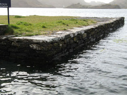 quay/wharf201 yd
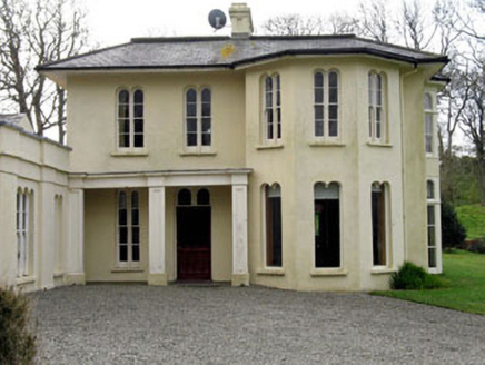 Lough Ine HouseHunting/fishing lodge · 260 ydHoly well in Pookeen (carbery West (e.d) By.)Holy well · 494 ydClochánCastle · 556 yd
 Shour WellHoly well · 670 yd
 KnockomaghMountain / peak · 1031 ydWalk 5 - Lough Hyne (7km)Walking route · 1186 ydTrá na BóBeach / strand · 1537 yd
 Bullock IslandIslet · 1734 yd
 Drishane IslandIslet · 1.5 mi
 Lough HyneVisitor information · 1.8 mi
More archaeology and monuments in County Cork · All of County Cork
What do you know about this place?