What is recorded here
In pasture. Triangular area defined by differential growth to E (L 20m) and W (L 19.3m); field fence to S. Five possible grave markers noted.
From the National Monuments Service (Archaeological Survey of Ireland) record CO151-001
The monument record does not grant public access. Check the route and ask the landowner before entering private land.
- What survives
- Recorded monument
Places near here
Photo credits
- Mike Searle, Geograph · CC BY-SA 2.0
- National Inventory of Architectural Heritage
- Mac McCarron, Geograph · CC BY-SA 2.0
- Gordon Hatton, Geograph · CC BY-SA 2.0
Hut site in Lahardane MoreHut site · 434 ydEnclosure in Lahardane MoreEnclosure · 438 ydGiant's GraveArchaeological place · 550 ydBealach (pass)Viewpoint · 977 yd Liss ArdGate lodge · 1095 ydCarraigín Na SúlViewpoint · 1317 ydLake LodgeCountry house · 1433 ydSuí FinnMountain / peak · 1550 ydIrish Sky GardenHeritage attraction · 1748 ydThe SpringSpring · 1.1 miDrishane IslandIslet · 1.5 miSandy CoveBeach / strand · 2.0 mi
 Liss ArdGate lodge · 1095 ydCarraigín Na SúlViewpoint · 1317 yd
 Lake LodgeCountry house · 1433 ydSuí FinnMountain / peak · 1550 ydIrish Sky GardenHeritage attraction · 1748 ydThe SpringSpring · 1.1 mi
 Drishane IslandIslet · 1.5 mi
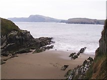 Sandy CoveBeach / strand · 2.0 mi
More archaeology and monuments in County Cork · All of County Cork
What do you know about this place?