What is recorded here
In reclaimed pasture on N-facing slope. Circular area (18m N-S; 18m E-W) enclosed by bank (pers. comm Paul Walsh 1986). According to landowner, bank was accidently disturbed by bulldozer c. 1987; later restored to previous form. Interior level; cut slightly into hillslope and now covered withstones from bank. Several upright slabs at NW may represent remains of external bank revetment.
From the National Monuments Service (Archaeological Survey of Ireland) record CO151-046
The monument record does not grant public access. Check the route and ask the landowner before entering private land.
- What survives
- Recorded monument
Places near here
Photo credits
- Mike Searle, Geograph · CC BY-SA 2.0
- National Inventory of Architectural Heritage
- Mac McCarron, Geograph · CC BY-SA 2.0
- Gordon Hatton, Geograph · CC BY-SA 2.0
- Superbass, Wikimedia Commons · CC BY-SA 4.0
- Kondephy, Wikimedia Commons · CC BY-SA 4.0
Giant's GraveArchaeological place · 449 ydBealach (pass)Viewpoint · 606 ydCarraigín Na SúlViewpoint · 906 ydSuí FinnMountain / peak · 1250 yd Liss ArdGate lodge · 1513 ydThe SpringSpring · 1584 ydLake LodgeCountry house · 1.0 miFall DownWaterfall · 1.1 miDrishane IslandIslet · 1.6 miSandy CoveBeach / strand · 1.7 miIndicatedFairy fort / stone ringfort · 2.1 miCnoc DromaArchaeological place · 2.1 mi
 Liss ArdGate lodge · 1513 ydThe SpringSpring · 1584 yd
 Lake LodgeCountry house · 1.0 miFall DownWaterfall · 1.1 mi
 Drishane IslandIslet · 1.6 mi
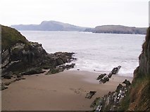 Sandy CoveBeach / strand · 1.7 mi
 IndicatedFairy fort / stone ringfort · 2.1 mi
 Cnoc DromaArchaeological place · 2.1 mi
More archaeology and monuments in County Cork · All of County Cork
What do you know about this place?