What is recorded here
In rough grazing, on N-facing slope between two ridges running c. E-W, one of rock outcrop. Oval area (24.5m E-W; 12m N-S) defined by rough line ofwalling (H c. 0.3m) to N and E; interior cut into hillslope on S side, forming scarp (H 1.3m), walling runs along top of scarp SE->S and SSW->SW; low bank of stones to W. Break in wall to NE (Wth 2.4m). Immediately inside W bank are two upright parallel stones (H 0.32m; 0.58m x 0.07m: H 0.5m; 0.54m x 0.12m) 0.71m apart and aligned NE-SW. Third upright stone (H 0.31m; 0.47m x 0.11m) 0.2m to E of most northerly parallel is aligned ENE-WSW. Fourth stone (H 0.84m; 0.5m x 0.21m) lies 5.18m S of last and is aligned N-S. Interior heavily overgrown with ferns; S half slopes gently to N.
In rough grazing, on N-facing slope between two ridges running c. E-W, one of rock outcrop. Oval area (24.5m E-W; 12m N-S) defined by rough line ofwalling (H c. 0.3m) to N and E; interior cut into hillslope on S side, forming scarp (H 1.3m), walling runs along top of scarp SE->S and SSW->SW; low bank of stones to W. Break in wall to NE (Wth 2.4m). Immediately inside W bank are two upright parallel stones (H…
From the National Monuments Service (Archaeological Survey of Ireland) record CO151-045
The monument record does not grant public access. Check the route and ask the landowner before entering private land.
- What survives
- Recorded monument
Places near here
Photo credits
- Mike Searle, Geograph · CC BY-SA 2.0
- National Inventory of Architectural Heritage
- Mac McCarron, Geograph · CC BY-SA 2.0
- Gordon Hatton, Geograph · CC BY-SA 2.0
Giant's GraveArchaeological place · 132 ydEnclosure in Lahardane MoreEnclosure · 336 ydKill Burial Ground (Children)Burial ground · 434 ydBealach (pass)Viewpoint · 922 ydCarraigín Na SúlViewpoint · 958 yd Liss ArdGate lodge · 1501 ydSuí FinnMountain / peak · 1579 ydThe SpringSpring · 1680 ydLake LodgeCountry house · 1.1 miFall DownWaterfall · 1.1 miDrishane IslandIslet · 1.4 miSandy CoveBeach / strand · 1.9 mi
 Liss ArdGate lodge · 1501 ydSuí FinnMountain / peak · 1579 ydThe SpringSpring · 1680 yd
 Lake LodgeCountry house · 1.1 miFall DownWaterfall · 1.1 mi
 Drishane IslandIslet · 1.4 mi
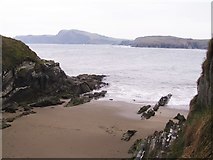 Sandy CoveBeach / strand · 1.9 mi
More archaeology and monuments in County Cork · All of County Cork
What do you know about this place?