
What is recorded here
Marked on the OS 6-inch maps as Kilbride, the site consists of a subrectangular enclosure c. 32m E-W × c. 20m N-S. There is an entrance in the NE corner. The W side of the site is raised above the external ground. Just W of the enclosure is a standing stone 1.75m high and 0.65m N-S and 0.34m to .21m thick. On the W…
Read the whole record
From the National Monuments Service (Archaeological Survey of Ireland) record DG011-037001
Places near here
Photo credits
- Maker not stated on source page, en.wikipedia.org
- National Inventory of Architectural Heritage
- Maker not stated on source page, commons.wikimedia.org
- Visit Carndonagh, Wikimedia Commons
- Maker not stated on source page, au.pinterest.com
- Picture: Barrack Hill Town Park
- Andreas F. Borchert, Wikimedia Commons · CC BY-SA 4.0
- Picture: Go Visit Inishowen
- Diamond Café visitor photograph on Tripadvisor, Tripadvisor
- Picture: Think Business
 Cross-inscribed stone in BallyloskyCross-inscribed stone · 38 yd
Explorer Tom Ballylosky's standing slab carries a cross with D-shaped ends on its west face. A shallow human face is cut into the…
 Carndonagh District HospitalGraveyard/cemetery · 205 yd
Explorer Tom Carndonagh District Hospital is actually a graveyard holding secrets from the Famine era. The gate sign says 'In Memory…
 Mount Saint Mary ConventGraveyard/cemetery · 271 yd
Explorer Tom Mount Saint Mary Convent graveyard feels like a secret whisper from c. 1880. The Sisters of Mercy kept it simple…
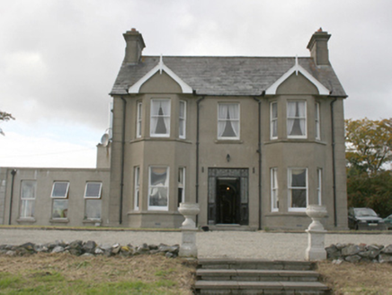 Donagh Lodge b&bHouse · 381 yd
Explorer Tom Donagh Lodge B&B, built around 1910, makes quite an entrance: iron gates, coloured glass, double doors, then bay…
 Former Ballylosky Fairy FortFairy fort / earthen ringfort · 409 yd
Explorer Tom Former Ballylosky Fairy Fort was marked as a single ring on an old map. The survey found no trace in what it described…
 Barrack Hill Town ParkPark · 635 yd
Explorer Tom Barrack Hill Town Park is Carndonagh's answer to anyone who thinks a proper Donegal discovery must involve a mountain…
 Mapped graveyardGraveyard · 682 yd
Explorer Tom This mapped graveyard’s favourite song is 'The Wild Rover' because it fits perfectly with the vibe of being slightly…
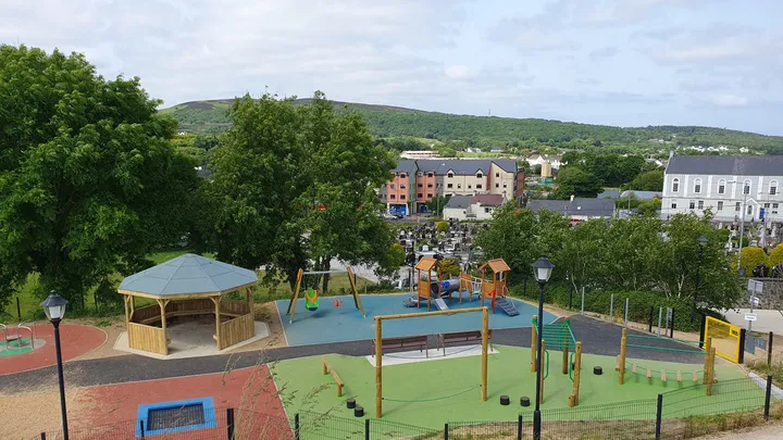 Barrack Hill Town Park PlaygroundChildren's playground · 701 yd
Explorer Tom At Barrack Hill, little legs get the climbing frames, swings, balance beams and monkey bars. The roundabout was…
 Carndonagh Early Church GraveyardGraveyard · 707 yd
Explorer Tom Carndonagh Early Church Graveyard makes me slow the map down: it surrounds an eighteenth-century church thought to…
 Corner CoffeeCafé · 835 yd
Explorer Tom Corner Coffee is literally in a corner, so they’ve given up on center stage. Ask if their coffee has corners; if it…
 Diamond CaféCafé · 922 yd
Explorer Tom Diamond Café in Carndonagh serves regional salads that taste like a hedgehog harvested them. There is definitely a…
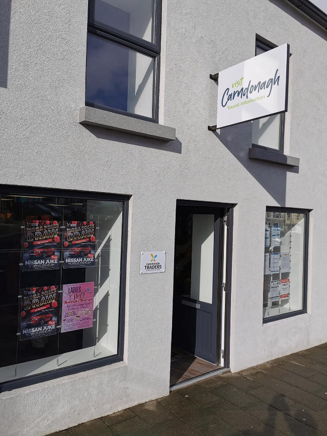 Visit CarndonaghVisitor information · 941 yd
Explorer Tom Visit Carndonagh in County Donegal is where the builder was really thinking, 'I’ll just put this here and hope nobody…
More archaeology and monuments in County Donegal · All of County Donegal

What do you know about this place?Tap to add a comment or ask a question