
Places near here
Photo credits
- Kenneth Allen, Wikimedia Commons · CC BY-SA 2.0
- National Inventory of Architectural Heritage
- Kenneth Allen, Geograph · CC BY-SA 2.0
- Jonathan Wilkins, Geograph · CC BY-SA 2.0
 Dungravenen Promontory FortPromontory fort, coastal · 156 yd
Explorer Tom Dungravenen Promontory Fort is a spectacular coastal spot where you can crawl through rock-cut chambers under the soil. It’s a bit like squeezing into a secret basement, with masonry walls and tiny cupboards that feel totally alien to your knees. Just remember the flagstones are doing all the heavy lifting up there.
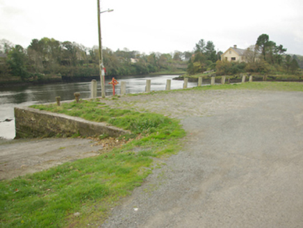 quay/wharf199 yd
Explorer Tom Quay or wharf in Townparks has been soaking up the Atlantic since the River Erne met the sea back in the eighteenth century. It’s rugged rubble stone that survived the port’s heyday, so don’t be shy about checking out this old workhorse of Ballyshannon.
 Inis SamerHouse · 216 yd
Explorer Tom Inis Samer is a grand 1885 residence that has kept its original door hidden behind a 1960 porch, like a shy guest. It now doubles as a guest house, so you might just bump into history while checking in.
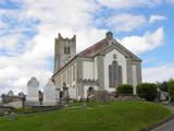 St Anne's Church GraveyardGraveyard · 583 yd
Explorer Tom St Anne's Church Graveyard is where the real history of Ballyshannon sleeps, next to a church that moved in 1691 and got new bones in 1841. It’s serious business with a side of tradition. Great spot to propose. Or at least to propose lunch, keep it light.
 McGinley's BarPub · 644 yd
Explorer Tom McGinley's Bar in County Donegal was nearly sold for a horse, which is either amazing or terrifying depending on your view of value. Serious arguments happen over trivial pub trivia here, so keep your wits about you. Linger, it's not going anywhere and neither should you.
 Shannon's CornerRestaurant · 714 yd
Explorer Tom Shannon's Corner restaurant in Donegal would bring a very unremarkable cake to a party because it’s terrified of being too interesting. It sits at the corner looking mysterious but mostly just confused. Dare you to say hello to it out loud.
 Rory GallagherMemorial · 812 yd
Explorer Tom Rory Gallagher memorial? That's just a guy who played guitar, right? Well, sort of. Go back in winter, it's a different animal when the wind is howling and you're pretending you know what you're doing.
CastleCastle, unclassified · 917 ydExplorer Tom Castle at Townparks guarded the River Erne ford and got torched in 1522. Red Hugh O’Donnell even stopped here after escaping prison in 1592. It’s all gone now, but you can imagine the fire raining down on the soldiers below.
 Standing stone in Townparks (ballyshannon Ed)Standing stone · 1115 yd
Explorer Tom Standing stone in Townparks is roughly 1.3m high and set on rock outcrop, possibly just a natural feature rather than a true standing stone. Locals say it marks a fording place of the river Erne, but with 'cat's paw' markings that might be natural too, it’s hard to know if it’s a guide or just a grumpy rock.
 Wardtown StrandBeach / strand · 1.6 mi
Explorer Tom Wardtown Strand has regular navigation marker-poles indicating the sinuous river channel. I reckon those poles are doing a lot of heavy lifting while the sand just sits there, wet and unbothered. It is a very organized mess.
 Tullan StrandBeach / strand · 1.8 mi
Explorer Tom Tullan Strand gets the Atlantic swell head-on along Bundoran's north side. Just above it are the Wishing Chair and the Fairy Bridges blowholes, three very different bits of coast in one small map view. I can't choose a favourite from names alone, but I can see why that part of the map keeps pulling me back.
Castle in ruinsCastle, unclassified · 2.0 miExplorer Tom This Castle in ruins used to be a tower-house right on the bank of the River Erne, but now it’s been submerged by the hydro-electric scheme. It’s like a secret underwater puzzle box that you can only imagine from the shore.

What do you know about this place?Tap to add a comment or ask a question