What is recorded here
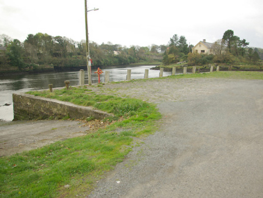
Pier and quay on roughly rectangular-plan, built c. 1775 and altered c. 1835 and 1880. Possibly containing pre-1700 fabric. Modified with concrete rendered slipways (modern?) to the north and to the south-east. Constructed of coursed and roughly squared rubble stone masonry having cut stone coping (with cement repairs) to the margins. Rubble stone paving to deck. Flight of cut stone steps to the south having modern metal railing. Timber retaining supports attached to the south elevation. Carved timber bollard/mooring post to the south-west corner, cast-iron bollards/mooring posts to the south elevation. Metal ringlets/link chains to slipways. Located at the mouth of the Rover Erne, facing Inis Samer Island to the south-west, and to the west of Ballyshannon town centre.
This utilitarian structure acts as a tangible historical reminder of the importance of Ballyshannon as a thriving port and regional market centre, particularly during the late-eighteenth and the nineteenth centuries. It is robustly-built using local rubble stone masonry, and its survival is testament to the quality of the original construction. Sited at the mouth of the River Erne, where it flows into the Atlantic Ocean, the port at Ballyshannon was regularly visited by shipping travelling to and from Britain, North America and mainland Europe throughout the late-eighteenth, nineteenth and early twentieth centuries. Imports through here included wine, iron, salt, sugar, coke, slates, clay, timber (particularly deal), and building materials (the building materials for Wyatt’s Castle Coole house, near Enniskillen, were imported through Ballyshannon in the 1790s for instance); while wool, meat, linen, leather, local iron (from near Pettigoe and Stranorlar), and salted fish were exported from here. However, the majority of goods passing from Ballyshannon were destined for other Irish ports, particularly Dublin (Begley 2009). This jetty was also the site where many thousands of passengers and emigrants left Ireland during the nineteenth-century (particularly during the years of the Great Famine (c. 1845 – 1851) and in the decades afterwards) on their way to North America etc. The port/harbour at Ballyshannon was hindered by the presence of a dangerous sandbar in the estuary, which meant that the larger ships could not come into the port but had to move the goods/passengers to and from smaller boats to reach the shore/larger boats here (goods were also regularly unloaded at Killybegs – then a subsidiary port of Ballyshannon - and later transported to Ballyshannon by smaller vessels). This quay was apparently constructed or remodelled for a Dr Sheil prior to 1836 (‘First Report of the Commissioners of Inquiry into The State of the Irish Fisheries’; also on Ordnance Survey first edition six-inch map of c. 1836; also mentioned in Pigot’s Directory of 1824), and was later purchased from the Sheil family by the Ballyshannon Harbour Commissioners (for £137-10-00) in 1888. Works were carried out on the harbour by Robert Stevenson (1772 - 1850), a Scottish engineer, in 1835 - 6 (IAA), which may have included works on this site. The harbour/quay appears to have declined in importance by the end of the nineteenth-century. It is possible that the present structure contains the fabric of – or occupies the site of – an earlier pier(s) and/or jetties as Ballyshannon has had a harbour dating back to the early seventeenth-century and probably beforehand.
From the Buildings of Ireland (National Inventory of Architectural Heritage) record 40852043
This does not grant access. Most recorded buildings are privately owned; view them only from public ground unless the owner allows entry.
Places near here
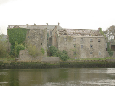 Erne MillsStore/warehouse · 96 yd
 Erne MillsStore/warehouse · 96 yd
 Dungravenen Promontory FortPromontory fort, coastal · 287 yd
 St Anne's Church GraveyardGraveyard · 404 yd
 Rory GallagherMemorial · 614 yd
 Standing stone in Townparks (ballyshannon Ed)Standing stone · 925 yd
 Wardtown StrandBeach / strand · 1.7 mi
 Tullan StrandBeach / strand · 1.9 mi
 Cliffs by BundoranPublicly named cliff or headland · 2.8 mi
 Dark Cliffs at KilbarronPublicly named cliff or headland · 3.0 mi
 Kilbarron Castle in ruinsCastle, tower house · 3.1 mi
 Hawthorn3.5 mi
Pictures: National Inventory of Architectural Heritage; Kenneth Allen, Wikimedia Commons · CC BY-SA 2.0; Kenneth Allen, Geograph · CC BY-SA 2.0; Jonathan Wilkins, Geograph · CC BY-SA 2.0; Jonathan Wilkins, Wikimedia Commons · CC BY-SA 2.0; louise price, Wikimedia Commons · CC BY-SA 2.0; Didier Descouens, Wikimedia Commons · CC BY-SA 4.0
More historic places in County Donegal · All of County Donegal
What do you know about this place?